5327 Eighth Line
1044 - TR Rural Trafalgar, Milton, L0P 1E0
$5,999,000
- 3 bedrooms
- 1 bathrooms
- 80 parking
- 1500-2000 sq ft
Listed 98 days ago · MLS® W13559132
About this home
Prime 15 Acre Parcel Ideally Located Between Milton And Mississauga Offering Exceptional Long-Term Potential. Currently Zoned A1, This Property Falls Within The Town Of Milton's Urban Area And Is Identified As Future Employment Area In The Town's Planning Documents (Schedule 2: Growth Phases And Planning Policy Areas). A Rare Opportunity For Investors, End Users, Or Land Bank Buyers Looking To Secure A Strategic Parcel In A Rapidly Expanding Corridor.The Property Features A Well-Maintained 1 Storey Bungalow Built On A Slab Foundation, Offering Over 1,900 Sq Ft Of Living Space With 3 Bedrooms And A Functional Layout. A Greenhouse Is Also Located On The Property, Providing Added Utility For Agricultural Use Or Hobby Farming.The Land Is Generally Flat And Open, Providing Flexible Outdoor Space For Uses Permitted Under Current Zoning While Offering Long-Term Potential.Conveniently Located With Easy Access To Major Highways, Surrounding Employment Lands, And Ongoing Development In The Area.
Details
- Type
- Rural Residential
- Style
- 1 Storey/Apt
- Size
- 1500-2000 sq ft
- Lot
- 297.33 × 2217.86 ft
- Basement
- None
- Garage
- None
- Kitchens
- 1
- Property tax
- $2,046 (2025)
- Neighbourhood
- 1044 - TR Rural Trafalgar
- Municipality
- Milton
Interior
- Bedrooms
- 3 above ground
- Bathrooms
- 1 × 3-piece
- Rooms
- 7 above ground
- Family room or den
- Yes
- Fireplace
- No
Heating, cooling and services
- Heating
- Baseboard, Electric
- Air conditioning
- Wall Unit(s)
- Water and sewer
- Septic
Building and exterior
- Style
- 1 Storey/Apt
- Exterior
- Board & Batten
- Roof
- Asphalt Shingle
- Foundation
- Slab, Concrete
- Faces
- West
Parking
- Total parking
- 80
Lot
- Size
- 297.33 × 2217.86 ft
- Acreage
- 10-24.99
More
- Possession
- Flexible
- Cross street
- Lower Base/Eighth Line
History of this address
1 earlier listing at this address, with sold and leased prices. Create a free account or sign in to see them.
Location
Location is approximate. See nearby homes on the map
Recent sales nearby
See what similar homes within 1 km sold for in the last year. Create a free account or sign in to see them.
The neighbourhood
Getting around Car-dependent
- 🚆 Streetsville GO6.0 km
Within a 10-minute walk: no grocery stores, 0 cafés and restaurants, 0 parks.
Schools nearby
Elementary
- St. Bernard of Clairvaux Catholic Elementary School Catholic
EQAO: Gr 6 reading 90%, math 58%2.2 km
Secondary
- Ruth Thompson Middle School2.3 km
- Saint Joan of Arc Catholic Secondary School Catholic
EQAO: Gr 9 math 70%, literacy test 86%2.3 km
EQAO: share of students meeting the provincial standard (2024–25). Ontario average: Gr 6 reading 86%, math 51%; Gr 9 math 55%; literacy test 83%.
Closest schools, not school zones. Check which school serves this address with the school board before relying on it.
Who lives here postal area L0P
- Owners / renters
- 91% / 9%
- Median household income
- $135,000
- Average age
- 44
- Children under 15
- 14%
- Homes
- 97% detached
- Commute by transit
- 1%
- Population
- 7,779
Languages spoken most at home besides English: Punjabi (Panjabi) 2.6%, Polish 0.7%, Urdu 0.5%, Spanish 0.3%.
Flood and conservation No mapped hazard
Not inside a mapped flood plain or regulated area in Credit Valley Conservation’s mapping.
Screening maps only. Ask the conservation authority for a property inquiry before relying on this.
Safety
Crime Severity Index for Halton Region (Oakville/Burlington) police: 31 vs 57 for Ontario (2025).
Police-reported figures for the whole police service area, not this street. Rates use the area’s resident population.
Distances are approximate. Places © OpenStreetMap contributors. Neighbourhood figures: Statistics Canada, 2021 Census. School results: EQAO via Ontario Data Catalogue (Open Government Licence – Ontario). Flood and regulation mapping: Credit Valley Conservation open data. Crime Severity Index: Statistics Canada.
Living here
Commute
To Union Station (downtown Toronto): 33 km. Transit times · Driving times
Noise Nothing major nearby
No highway within 500 m, rail line within 300 m, or airport flight path nearby.
Distances from the map, not noise measurements. Visit at rush hour to judge for yourself.
Internet High-speed
50/10 Mbps or faster available here by cable, fibre or DSL (the federal high-speed target).
From the federal broadband map. Check exact speeds and providers for the address.
Roads, rail, airports and planned stations © OpenStreetMap contributors. Internet: Innovation, Science and Economic Development Canada, National Broadband Data.
Listed by Royal LePage Real Estate Associates.
Listing information provided by PropTx Innovations Inc. and TRREB; deemed reliable but not guaranteed accurate by PropTx.
Similar homes nearby
See more in Milton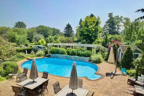
$4,999,000
Reduced $494,901,000
3+1 bd2 ba104 pk1500-2000 ft²
5189 Eighth Line
1044 - TR Rural Trafalgar, Milton
Rural Residential · MLS® W13221740 · RE/MAX REALTY SPECIALISTS INC.
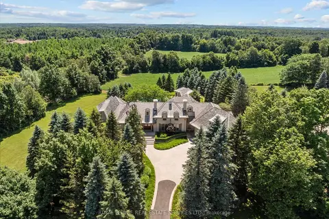
$5,998,000
Reduced $201,000
4 bd6 ba9 pk5000 + ft²
10090 Pineview Trail
Rural Milton West, Milton
Detached · MLS® W13568144 · ROYAL LEPAGE REAL ESTATE SERVICES LTD.
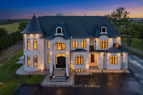
$5,990,000
6+2 bd9 ba15 pk5000 + ft²
7548 Sixth Line
1030 - DG Derry Green, Milton
Detached · MLS® W13085252 · RE/MAX OPTIMUM REALTY
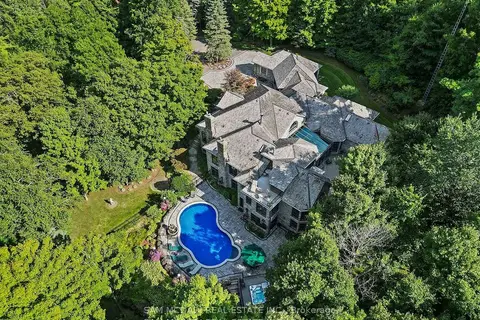
$5,339,000
3+2 bd8 ba14 pk5000 + ft²
10140 Pineview Trail
Rural Milton West, Milton
Detached · MLS® W13736758 · SAM MCDADI REAL ESTATE INC.