413 Keele Street
Junction Area, Toronto, M6P 2K9
$2,125/mo
- 1 bathrooms
Listed 152 days ago · MLS® W13152248
About this home
Prime retail opportunity in the heart of The Junction - This outstanding street-level retail space is available for lease at the base of two condo towers with over 300 residential units directly above. The area is experiencing further growth, with a brand-new condominium development now almost completed directly across the street, and another just beginning immediately to the south, bringing more foot traffic to the area. The unit features tall ceilings, hardwood floors, high-end finishes, and prominent frontage on Keele Street - a high-visibility corridor with steady pedestrian and vehicle exposure. This beautifully finished commercial unit is ideal for a variety of service-based businesses including a hair salon, barber shop, or other professional services. It is also well-suited for retail, medical, and office uses. Strategically located just steps from Dundas and Keele, in the core of The Junction - one of Toronto's most dynamic and sought-after neighbourhoods. The Junction is a thriving destination, known for its character, energy, and strong sense of community, and lined with popular restaurants, pubs, and boutique shops. The area attracts both local residents and visitors, creating an ideal setting for a business to grow. Base rent is $2,125 per month, TMI is $1,265.81 per month = $3,390.81 per month plus HST. All utilities except for water are included in the TMI.
Details
- Type
- Commercial Retail
- Age
- 6-15 years
- Garage
- Other
- Property tax
- $19 (2026)
- Neighbourhood
- Junction Area
- Municipality
- Toronto W02
Interior
- Bathrooms
- 1 × bathroom
Heating, cooling and services
- Heating
- Electric Forced Air
- Air conditioning
- Yes
- Water and sewer
- Sanitary
- Utilities
- Yes
Building and exterior
- Age
- 6-15 years
- Building area
- 785 Square Feet
Rental terms
- Minimum term
- 24 months
More
- Possession
- Immediate/TBA
- Cross street
- Keele Street and Dundas Street West
- Business type
- Retail Store Related
Location
Location is approximate. See nearby homes on the map
The neighbourhood
Getting around Very walkable
- 🚇 Keele Subway1.3 km
- 🚇 High Park Subway1.4 km
- 🚆 Mount Dennis GO3.0 km
Within a 10-minute walk: 5 grocery stores, 83 cafés and restaurants, 14 parks, 8 pharmacies. Nearest grocery: The Sweet Potato (300 m). Nearest park: Dundas-Watkinson Parkette (400 m).
Schools nearby
Elementary
- Indian Road Crescent Junior Public School
EQAO: Gr 6 reading 84%, math 79%9 min walk - St. Rita Catholic School Catholic
EQAO: Gr 6 reading 91%, math 36%10 min walk - Carleton Village Junior and Senior Public School
EQAO: Gr 6 reading 63%, math 24%12 min walk - École élémentaire Charles-Sauriol French
EQAO: Gr 6 reading 98%, math 88%12 min walk
Secondary
- Lucy McCormick Senior School7 min walk
- Humberside Collegiate Institute
EQAO: Gr 9 math 80%, literacy test 96%13 min walk
EQAO: share of students meeting the provincial standard (2024–25). Ontario average: Gr 6 reading 86%, math 51%; Gr 9 math 55%; literacy test 83%.
Closest schools, not school zones. Check which school serves this address with the school board before relying on it.
Who lives here postal area M6P
- Owners / renters
- 42% / 58%
- Median household income
- $86,000
- Average age
- 41
- Children under 15
- 14%
- Homes
- 11% detached, 43% high-rise
- Commute by transit
- 33%
- Population
- 39,870
Languages spoken most at home besides English: Portuguese 2%, Spanish 1.7%, Russian 1.1%, Polish 0.9%.
Flood and conservation No mapped hazard
Not inside a mapped flood plain or regulated area.
Screening maps only. Ask the conservation authority for a property inquiry before relying on this.
Safety
Major crime per resident in Junction Area (2025): 22% above the Toronto average, down 19% from the year before.
- Assaultabout average
- Break and enter61% above average
- Auto theftabout average
- Robberyabout average
- Theft from vehicles173% above average
- Shootings24% below average
Crime Severity Index for Toronto police: 60 vs 57 for Ontario (2025).
Police-reported figures for the whole neighbourhood, not this street. Rates use the area’s resident population.
Development nearby 8 active
-
301 KEELE ST · 400 mPlan of Condominium · Draft Plan Approved · applied 2025Draft Plan of Condominium for 4 residentail dwelling units.Application details
-
108 VINE AVE · 300 mOfficial Plan / Zoning By-law Amendment · OMB Appeal · applied 2025Proposed standalone Official Plan Amendment (OPA) application which seeks to only redesignate the lands comprising 108-162 Vine Avenue from Core Employment…Application details
-
410 KEELE ST · 50 mPlan of Condominium · Draft Plan Approved · applied 2025Draft Plan of Stamdard Condominium for 65 units.Application details
-
110 WEST TORONTO ST · 450 mOfficial Plan / Zoning By-law Amendment · Appeal Received · applied 2025The requested Official Plan Amendment seeks to redesignate the subject site from General Employment Areas to Mixed Use Areas. The proposal is being brought…Application details
-
52 LINDNER ST · 350 mSite Plan · Under Review · applied 2023The site plan application proposes mix of mid-rise and tall building typologies and includes two mid-rise buildings that range from 8- to 11-storeys and a…Application details
-
3001 DUNDAS ST W · 400 mSite Plan · NOAC Issued · applied 2021Site Plan Approval to convert the existing 1-storey place of worship into a 5-storey mixed-use building having a residential gross floor area of 1213.15 square…Application details
12 more within 500 m.
Rezoning, site plan, subdivision and condominium applications filed with the city.
Distances are approximate. Places © OpenStreetMap contributors. Neighbourhood figures: Statistics Canada, 2021 Census. School results: EQAO via Ontario Data Catalogue (Open Government Licence – Ontario). Neighbourhood crime: Toronto Police Service Public Safety Data Portal (Open Government Licence – Toronto Police Service). Crime Severity Index: Statistics Canada. Planning applications: City of Toronto open data.
Living here
Commute
To Union Station (downtown Toronto): 7 km. Transit times · Driving times
Noise 1 source nearby
- 🚆 Rail line (Galt Subdivision)50 m
Distances from the map, not noise measurements. Visit at rush hour to judge for yourself.
What can be built CR
Commercial Residential (with a site-specific exception).
From Toronto’s Zoning By-law 569-2013 map. Lot size, setbacks and trees decide what actually fits; check with a planner before you buy.
Building permits
No building permits at this address since 2014.
9 permits on this block of the street in the last 2 years, including 1 new home.
Permits filed with the City of Toronto. A permit doesn’t mean the work passed final inspection.
Trees
29 City street trees within 100 m, mostly maples. That’s fewer than the Toronto average of 42.
Trees on City boulevards only, not private yards or parks.
Internet High-speed
50/10 Mbps or faster available here by cable, fibre or DSL (the federal high-speed target).
From the federal broadband map. Check exact speeds and providers for the address.
Zoning, heritage, building permits and street trees: City of Toronto open data (Open Government Licence – Toronto). Roads, rail, airports and planned stations © OpenStreetMap contributors. Internet: Innovation, Science and Economic Development Canada, National Broadband Data.
Listed by RE/MAX WEST REALTY INC..
Listing information provided by PropTx Innovations Inc. and TRREB; deemed reliable but not guaranteed accurate by PropTx.
Similar homes nearby
See more in Toronto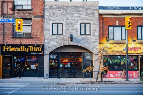
$2,300/mo
3030 DUNDAS Street #3
Junction Area, Toronto
Office · MLS® W13778336 · CENTURY 21 LEADING EDGE REALTY INC.
$2,123/mo
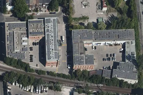
1 Wiltshire Avenue I
Weston-Pellam Park, Toronto
Commercial Retail · MLS® W13612096 · LENNARD COMMERCIAL REALTY
$2,129/mo
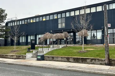
160 Tycos Drive 2206
Yorkdale-Glen Park, Toronto
Commercial Retail · MLS® W14084092 · AVISON YOUNG COMMERCIAL REAL ESTATE SERVICES, LP
$2,129/mo
160 Tycos Drive 2206
Yorkdale-Glen Park, Toronto
Office · MLS® W14084094 · AVISON YOUNG COMMERCIAL REAL ESTATE SERVICES, LP
$2,149/mo
Reduced $1
4438 Sheppard Avenue E 330
Agincourt South-Malvern West, Toronto
Commercial Retail · MLS® E12685310 · CYPRO REALTY INC.
$2,150/mo
497 Bloor Street W 16 (3rd)
University, Toronto
Commercial Retail · MLS® C12877720 · Royal LePage Real Estate Associates
$2,150/mo
1 ba
77 Florence Street L02
Little Portugal, Toronto
Office · MLS® C13755804 · HARVEY KALLES REAL ESTATE LTD.

$2,100/mo
3833 Midland Avenue 13
Milliken, Toronto
Office · MLS® E13654440 · RE/MAX EXCEL REALTY LTD.