3869 7th Line
Rural Innisfil, Innisfil, L9S 3M4
$3,400,000
- 4 bedrooms
- 3 bathrooms
- 20 parking
- 2500-3000 sq ft
Listed 76 days ago · MLS® N13638014
About this home
Prime 78.8-acre agricultural property on paved 7th Line, Innisfil, ideally located between the Village of Thornton and the rapidly growing Innisfil Beach Road / Hwy 400 corridor, backing onto the Hwy 400 Strategic Employment Area. Recent infrastructure upgrades, including the redeveloped Hwy 400 interchange and nearby DSV logistics facility, highlight the strong growth momentum in this area. Agricultural zoning allows immediate farm use and income, with a tenant in place, while offering significant long-term development and land-banking potential. The property features a character-filled century brick farmhouse of approximately 3,000+ sq. ft., with 4 bedrooms and 3 bathrooms, suitable for owner occupancy or rental income. Barns and outbuildings provide additional revenue opportunities. A rare opportunity not currently under major developer control, ideal for investors or end users seeking future upside in one of Innisfil's key growth areas. Approximately 5 minutes to Hwy 400. Priced to sell.
Details
- Type
- Farm
- Style
- 2 1/2 Storey
- Age
- 100+ years
- Size
- 2500-3000 sq ft
- Lot
- 807.25 × 2236.19 ft
- Basement
- Full, Unfinished
- Garage
- None
- Kitchens
- 1
- Property tax
- $5,484 (2025)
- Neighbourhood
- Rural Innisfil
- Municipality
- Innisfil
Interior
- Bedrooms
- 4 above ground
- Bathrooms
- 1 × 3-piece (main), 1 × 3-piece (second), 1 × 4-piece (third)
- Rooms
- 14 above ground + 2 below
- Family room or den
- Yes
- Fireplace
- Wood
- Features
- Water Heater
Heating, cooling and services
- Heating
- Forced Air, Propane
- Air conditioning
- Central Air
- Water and sewer
- Septic
Building and exterior
- Style
- 2 1/2 Storey
- Exterior
- Brick
- Roof
- Shingles
- Foundation
- Stone
- Age
- 100+
- Faces
- South
- Outdoor
- Barn
Parking
- Total parking
- 20
- Driveway and parking
- Private
Lot
- Size
- 807.25 × 2236.19 ft (irregular)
- Acreage
- 50-99.99
More
- Possession
- 30/60/TBA
- Nearby
- Level, School Bus Route
- Cross street
- 7th Line/Hwy. 400
Rooms
| Room | Level | Size | Features |
|---|---|---|---|
| Kitchen | Main | 3.68 × 4.9 m (12'1" × 16'1") | |
| Living Room | Main | 5.41 × 4.29 m (17'9" × 14'1") | |
| Office | Main | 3.78 × 4.29 m (12'5" × 14'1") | |
| Den | Main | 3.99 × 3.43 m (13'1" × 11'3") | |
| Bathroom | Main | 2.5 × 10 m (8'2" × 32'10") | 3 Pc Bath |
| Laundry | Main | 3 × 2 m (9'10" × 6'7") | |
| Primary Bedroom | Second | 4.37 × 4.32 m (14'4" × 14'2") | |
| Bedroom 2 | Second | 4.04 × 3.08 m (13'3" × 10'1") | |
| Bedroom 3 | Second | 4.04 × 3.4 m (13'3" × 11'2") | |
| Bathroom | Second | 3 × 2.5 m (9'10" × 8'2") | 3 Pc Bath |
| Bedroom 4 | Third | 5.49 × 3.63 m (18' × 11'11") | |
| Bathroom | Third | 4.04 × 3.63 m (13'3" × 11'11") | 4 Pc Bath |
History of this address
12 earlier listings at this address, with sold and leased prices. Create a free account or sign in to see them.
Location
Location is approximate. See nearby homes on the map
Recent sales nearby
See what similar homes within 1 km sold for in the last year. Create a free account or sign in to see them.
The neighbourhood
Getting around Car-dependent
No subway, LRT or GO station within a short trip.
Within a 10-minute walk: no grocery stores, 0 cafés and restaurants, 0 parks.
Who lives here postal area L9S
- Owners / renters
- 86% / 14%
- Median household income
- $100,000
- Average age
- 41
- Children under 15
- 18%
- Homes
- 89% detached, 2% high-rise
- Commute by transit
- 1%
- Population
- 33,434
Languages spoken most at home besides English: Russian 1.7%, Spanish 1%, Portuguese 0.7%, Italian 0.5%.
Flood and conservation No mapped hazard
Not inside a mapped flood plain or regulated area.
Screening maps only. Ask the conservation authority for a property inquiry before relying on this.
Safety
Crime Severity Index for South Simcoe (Innisfil) police: 32 vs 57 for Ontario (2025).
Police-reported figures for the whole police service area, not this street. Rates use the area’s resident population.
Distances are approximate. Places © OpenStreetMap contributors. Neighbourhood figures: Statistics Canada, 2021 Census. Crime Severity Index: Statistics Canada.
Living here
Commute
To Union Station (downtown Toronto): 74 km. Transit times · Driving times
Noise Nothing major nearby
No highway within 500 m, rail line within 300 m, or airport flight path nearby.
Distances from the map, not noise measurements. Visit at rush hour to judge for yourself.
Internet High-speed
50/10 Mbps or faster available here by cable, fibre or DSL (the federal high-speed target).
From the federal broadband map. Check exact speeds and providers for the address.
Roads, rail, airports and planned stations © OpenStreetMap contributors. Internet: Innovation, Science and Economic Development Canada, National Broadband Data.
Listed by PROHOME REALTY.
Listing information provided by PropTx Innovations Inc. and TRREB; deemed reliable but not guaranteed accurate by PropTx.
Similar homes nearby
See more in Innisfil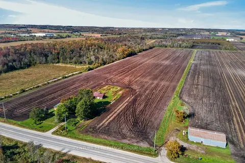
$3,500,000
4 bd1 ba10 pk1500-2000 ft²
3194 Simcoe County Road 89
Rural Innisfil, Innisfil
Farm · MLS® N13869718 · CENTURY 21 HERITAGE GROUP LTD.
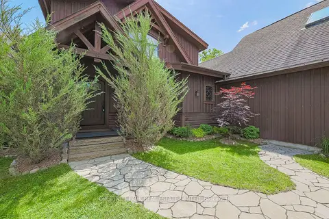
$3,599,000
3+2 bd4 ba12 pk1500-2000 ft²
3531 Crescent Harbour Road
Rural Innisfil, Innisfil
Detached · MLS® N13026976 · CHESTNUT PARK REAL ESTATE LIMITED
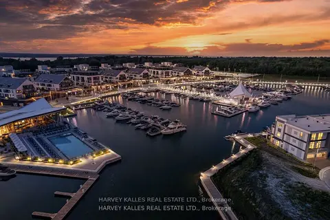
$2,899,999
5 bd5 ba4 pk3500-5000 ft²
3730 Mangusta Court
Rural Innisfil, Innisfil
Att/Row/Townhouse · MLS® N13439676 · HARVEY KALLES REAL ESTATE LTD.
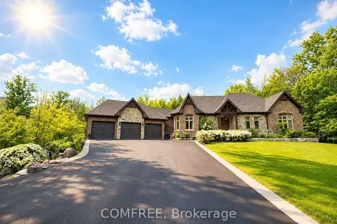
$2,850,000
Reduced $125,000
3+2 bd4 ba15 pk2500-3000 ft²
1707 Wilkinson Street
Rural Innisfil, Innisfil
Detached · MLS® N13453810 · COMFREE
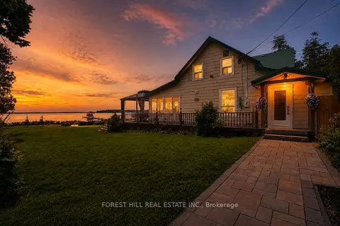
$2,888,000
5 bd3 ba10 pk2500-3000 ft²
1031 Wisker Avenue
Lefroy, Innisfil
Detached · MLS® N13595944 · FOREST HILL REAL ESTATE INC.