21 Rexdale Boulevard 4108
Etobicoke West Mall, Toronto, M9W 1P1
$99,900
Reduced $50,000 from $149,900
Listed 40 days ago · MLS® W13767210
About this home
"TURNKEY FRANCHISE BUSINESS Opportunity FOR SALE in Prime Etobicoke LOCATION (COSTCO and other big brand stores in the same Plaza) An incredible chance to own a fast-growing "Holy Shakes" franchise in one of the busiest plazas Fast growing franchisee Strategically located near Hwy 401, surrounded by Fully Residential Neighborhood Lots of foot traffic due to COSTCO customers Store Features A Dine-In Facility and an amazing Store Design, providing a Welcoming Atmosphere for Customers Exceptional Franchise Support ensuring smooth operations and Business Growth Approx 1500+ Sqft Retail Store Great Layout 20 seating inside; Fully Equipped Kitchen, 9-feet Kitchen Exhaust Hood (can be expanded to 12-Feet) Walk-in freezer, Cooler & Dining Furniture Included Rent $8500.40 (incl. TMI & HST) Lease Term: Existing 8.5 years + option to renew (for an additional 10-years) Royalty: 6%, Advertising: 2%
Details
- Type
- Sale Of Business
- Lot
- 29.25 × 60.5 ft
- Garage
- None
- Neighbourhood
- Etobicoke West Mall
- Municipality
- Toronto W08
Heating, cooling and services
- Heating
- Gas Forced Air Open
- Air conditioning
- Yes
Building and exterior
- Building area
- 1,568 Square Feet
More
- Possession
- Immediate
- Cross street
- ISLINGTON & REXDALE BLVD
- Business type
- Fast Food/Takeout
Price history
| Date | Price | Change |
|---|---|---|
| Sep 10, 2026 | $149,900 | Listed |
| Oct 19, 2026 | $99,900 | −$50,000 |
Location
Location is approximate. See nearby homes on the map
Recent sales nearby
See what similar homes within 1 km sold for in the last year. Create a free account or sign in to see them.
The neighbourhood
Getting around Very walkable
- 🚆 Etobicoke North GO16 min walk
Within a 10-minute walk: 4 grocery stores, 16 cafés and restaurants, 4 parks, 4 pharmacies. Nearest grocery: Walmart Supercentre (150 m). Nearest park: Rexlington Park (450 m).
Schools nearby
Elementary
- Elmlea Junior School
EQAO: Gr 3 reading 57%, math 39%8 min walk - St. Stephen Catholic School Catholic
EQAO: Gr 6 reading 78%, math 31%14 min walk - The Elms Junior Middle School
EQAO: Gr 6 reading 74%, math 28%15 min walk - Braeburn Junior School
EQAO: Gr 3 reading 71%, math 61%1.7 km
Secondary
- Can-AIM High School1.3 km
- School of Experiential Education1.5 km
- Monsignor Percy Johnson Catholic High School Catholic
EQAO: Gr 9 math 52%, literacy test 78%1.6 km
EQAO: share of students meeting the provincial standard (2024–25). Ontario average: Gr 6 reading 86%, math 51%; Gr 9 math 55%; literacy test 83%.
Closest schools, not school zones. Check which school serves this address with the school board before relying on it.
Who lives here postal area M9W
- Owners / renters
- 58% / 42%
- Median household income
- $85,000
- Average age
- 41
- Children under 15
- 15%
- Homes
- 37% detached, 32% high-rise
- Commute by transit
- 22%
- Population
- 40,977
Languages spoken most at home besides English: Punjabi (Panjabi) 6.8%, Spanish 3.2%, Gujarati 2.4%, Tagalog (Pilipino, Filipino) 1.5%.
Flood and conservation No mapped hazard
Not inside a mapped flood plain or regulated area.
Screening maps only. Ask the conservation authority for a property inquiry before relying on this.
Safety
Major crime per resident in West Humber-Clairville (2025): 127% above the Toronto average, down 14% from the year before.
- Assault22% above average
- Break and enter83% above average
- Auto theft486% above average
- Robbery94% above average
- Theft from vehicles158% above average
- Shootings228% above average
Crime Severity Index for Toronto police: 60 vs 57 for Ontario (2025).
Police-reported figures for the whole neighbourhood, not this street. Rates use the area’s resident population.
Development nearby
No planning applications within 500 m in the last five years.
Rezoning, site plan, subdivision and condominium applications filed with the city.
Distances are approximate. Places © OpenStreetMap contributors. Neighbourhood figures: Statistics Canada, 2021 Census. School results: EQAO via Ontario Data Catalogue (Open Government Licence – Ontario). Neighbourhood crime: Toronto Police Service Public Safety Data Portal (Open Government Licence – Toronto Police Service). Crime Severity Index: Statistics Canada.
Living here
Commute
To Union Station (downtown Toronto): 16 km. Transit times · Driving times
Noise 1 source nearby
- ✈️ In line with a Pearson runway5.1 km
Distances from the map, not noise measurements. Visit at rush hour to judge for yourself.
Building permits
- Interior Alterations · 2024 · InspectionInterior alterations to unit 4002 - Thai Express
- Interior Alterations · 2023 · ClosedInterior tenant suite build-out for a new retail tenant including new walls, doors, lighting, finishes, and limited HVAC, plumbing and…
- Interior Alterations · 2023 · InspectionInterior alterations to create a new beauty salon - Unit 4004 - Pedi N Nails Salon
- New Building · 2022 · CancelledConditional Permit - Proposal to construct a 2 storey retail building shell - C4
- Partial Permit - Structural Framing · 2022 · CancelledConditional Permit - Part Permit - Proposal to construct a 2 storey retail building shell - C4
2 permits on this block of the street in the last 2 years.
Permits filed with the City of Toronto. A permit doesn’t mean the work passed final inspection.
Trees
5 City street trees within 100 m, mostly zelkovas. That’s fewer than the Toronto average of 42.
Trees on City boulevards only, not private yards or parks.
Internet High-speed
50/10 Mbps or faster available here by cable, fibre or DSL (the federal high-speed target).
From the federal broadband map. Check exact speeds and providers for the address.
Zoning, heritage, building permits and street trees: City of Toronto open data (Open Government Licence – Toronto). Roads, rail, airports and planned stations © OpenStreetMap contributors. Internet: Innovation, Science and Economic Development Canada, National Broadband Data.
Listed by HOMELIFE/MIRACLE REALTY LTD.
Listing information provided by PropTx Innovations Inc. and TRREB; deemed reliable but not guaranteed accurate by PropTx.
Similar homes nearby
See more in Toronto
$99,900
2 ba
371 Old Kingston Road 9 & 10
Centennial Scarborough, Toronto
Sale Of Business · MLS® E13629628 · Re/Max Impact Realty
$99,900
1 ba
21 Canadian Road 5
Wexford-Maryvale, Toronto
Sale Of Business · MLS® E13817180 · EXP REALTY
$99,900
2 ba
1205 Queen Street W
South Parkdale, Toronto
Sale Of Business · MLS® W13625826 · RE/MAX NOBLECORP REAL ESTATE
$99,900
Reduced $28,900
2285 Dundas Street W
High Park-Swansea, Toronto
Sale Of Business · MLS® W13766622 · CENTURY 21 NEW CONCEPT
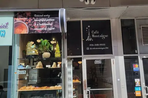
$99,888
394 Richmond Street W
Waterfront Communities C1, Toronto
Sale Of Business · MLS® C12916294 · HOMELIFE/FUTURE REALTY INC.
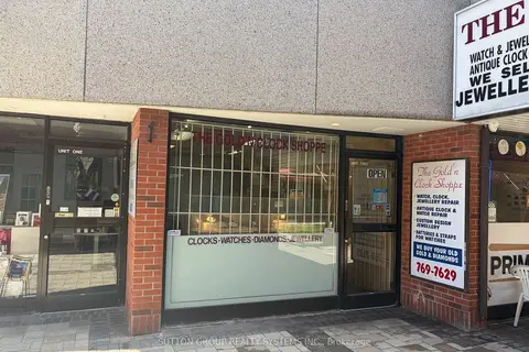
$99,998
1 ba
2323 Bloor Street 102
High Park-Swansea, Toronto
Sale Of Business · MLS® W13128594 · SUTTON GROUP REALTY SYSTEMS INC.
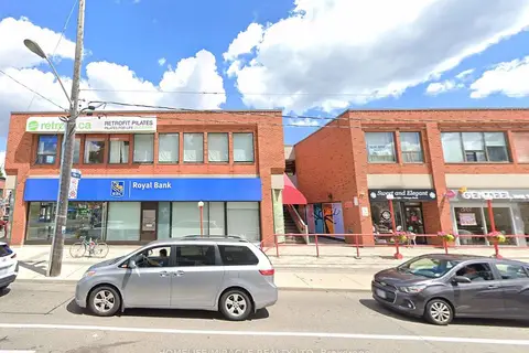
$99,999
1 ba
2323 Bloor Street W 8
High Park-Swansea, Toronto
Sale Of Business · MLS® W12656492 · HOMELIFE/MIRACLE REALTY LTD

$99,999
1 ba
2323 Bloor Street W
High Park-Swansea, Toronto
Sale Of Business · MLS® W12657820 · HOMELIFE/MIRACLE REALTY LTD