1438A Dufferin Street
Dovercourt-Wallace Emerson-Junction, Toronto, M6H 3L1
$2,499,900
Listed 47 days ago · MLS® W13740226
About this home
Offering 5 total units, this exceptional mixed-use commercial/residential property presents an outstanding turn-key investment opportunity in the heart of Dovercourt Village! Welcome to 1438A Dufferin St., thoughtfully updated throughout with modern, high-quality finishes while preserving its original character and charm. The main level features a modern, newly renovated restaurant space complete with a large outdoor patio, complemented by four spacious, updated residential units-including 3 - 1 bedroom apartments and 1 lower-level bachelor each featuring a 3-piece bathroom and wall-mounted A/C unit. Tenants can access a shared second-floor coin-operated laundry facility. Boasting strong current revenue and ROI alongside future development potential, this high-yield asset delivers exceptional value in an unbeatable location with a 94 Walk Score and 81 Transit Score.
Details
- Type
- Store W Apt/Office
- Lot
- 14.75 × 120.17 ft
- Garage
- None
- Property tax
- $9,525 (2026)
- Neighbourhood
- Dovercourt-Wallace Emerson-Junction
- Municipality
- Toronto W02
Heating, cooling and services
- Heating
- Gas Forced Air Open
- Air conditioning
- Yes
- Utilities
- Yes
Building and exterior
- Building area
- 3,440 Square Feet
More
- Possession
- TBA
- Cross street
- Dufferin St. | Davenport Rd.
History of this address
5 earlier listings at this address, with sold and leased prices. Create a free account or sign in to see them.
Location
Location is approximate. See nearby homes on the map
Recent sales nearby
See what similar homes within 1 km sold for in the last year. Create a free account or sign in to see them.
The neighbourhood
Getting around Very walkable
- 🚇 Dufferin Subway1.3 km
- 🚇 Lansdowne Subway1.3 km
- 🚆 Mount Dennis GO4.2 km
Within a 10-minute walk: 8 grocery stores, 70 cafés and restaurants, 17 parks, 14 pharmacies. Nearest grocery: FreshCo (400 m). Nearest park: Brandon Avenue Parkette (50 m).
Schools nearby
Elementary
- St. Mary of the Angels Catholic School Catholic
EQAO: Gr 6 reading 90%, math 59%2 min walk - Regal Road Junior Public School
EQAO: Gr 6 reading 88%, math 45%5 min walk - Dovercourt Public School
EQAO: Gr 6 reading 73%, math 32%8 min walk - St. Clare Catholic School Catholic
EQAO: Gr 6 reading 70%, math 40%14 min walk
Secondary
- Loretto College School Catholic9 min walk
- Oakwood Collegiate Institute
EQAO: Gr 9 math 44%, literacy test 88%14 min walk - Winona Drive Senior Public School17 min walk
EQAO: share of students meeting the provincial standard (2024–25). Ontario average: Gr 6 reading 86%, math 51%; Gr 9 math 55%; literacy test 83%.
Closest schools, not school zones. Check which school serves this address with the school board before relying on it.
Who lives here postal area M6H
- Owners / renters
- 48% / 52%
- Median household income
- $83,000
- Average age
- 41
- Children under 15
- 12%
- Homes
- 11% detached, 18% high-rise
- Commute by transit
- 30%
- Population
- 43,730
Languages spoken most at home besides English: Portuguese 8.5%, Spanish 2.3%, Yue (Cantonese) 1.8%, Italian 1.4%.
Flood and conservation No mapped hazard
Not inside a mapped flood plain or regulated area.
Screening maps only. Ask the conservation authority for a property inquiry before relying on this.
Safety
Major crime per resident in Junction-Wallace Emerson (2025): about the Toronto average, down 9% from the year before.
- Assaultabout average
- Break and enter22% above average
- Auto theft52% below average
- Robbery54% below average
- Theft from vehiclesabout average
- Shootings56% below average
Crime Severity Index for Toronto police: 60 vs 57 for Ontario (2025).
Police-reported figures for the whole neighbourhood, not this street. Rates use the area’s resident population.
Development nearby 8 active
-
259 GEARY AVE · 250 mSite Plan · Under Review · applied 2026
-
1423 DUFFERIN ST · 50 mSite Plan · Application Received · applied 2026Proposed 9-storey (28.5 metre) apartment, containing 60 residential units with a total of 3,817 square metres of residential GFA and 122 square metres of…Application details
-
1245 DUPONT ST · 400 mSite Plan · Under Review · applied 2026Site Plan Control application for Block 3A of 1245 Dupont Street that includes the construction of a 50 storey (156.95 metres) market rental building with 588…Application details
-
259 GEARY AVE · 250 mSite Plan · NOAC Issued · applied 2024Site Plan Approval for a 8-storey self-storage building with a total gross floor area of 22,734 square metres on the westerly portion of the subject lands…Application details
-
288 GEARY AVE · 200 mPlan of Condominium · Draft Plan Approved · applied 2023Draft Plan of Standard Condominium for 39 office condominium units and 18 parking spaces.Application details
-
1245 DUPONT ST · 400 mOfficial Plan / Zoning By-law Amendment · OMB Appeal · applied 2022Official Plan and Zoning By-law Amendment to increase the approved height and density onsite to accomodate additional purpose built and affordable rental…Application details
7 more within 500 m.
Rezoning, site plan, subdivision and condominium applications filed with the city.
Distances are approximate. Places © OpenStreetMap contributors. Neighbourhood figures: Statistics Canada, 2021 Census. School results: EQAO via Ontario Data Catalogue (Open Government Licence – Ontario). Neighbourhood crime: Toronto Police Service Public Safety Data Portal (Open Government Licence – Toronto Police Service). Crime Severity Index: Statistics Canada. Planning applications: City of Toronto open data.
Living here
Commute
To Union Station (downtown Toronto): 6 km. Transit times · Driving times
Noise 1 source nearby
- 🚆 Rail line (North Toronto Subdivision)250 m
Distances from the map, not noise measurements. Visit at rush hour to judge for yourself.
What can be built R
Residential (with a site-specific exception).
- ✅ Up to 6 homes on the lot (multiplex): a sixplex ward
- ✅ Garden suite in the backyard
- ✅ Laneway suite, if the lot backs onto a lane
From Toronto’s Zoning By-law 569-2013 map. Lot size, setbacks and trees decide what actually fits; check with a planner before you buy.
Building permits
No building permits at this address since 2014.
6 permits on this block of the street in the last 2 years, including 2 new homes.
Permits filed with the City of Toronto. A permit doesn’t mean the work passed final inspection.
Trees
42 City street trees within 100 m. That’s about the Toronto average of 42.
Trees on City boulevards only, not private yards or parks.
Internet High-speed
50/10 Mbps or faster available here by cable, fibre or DSL (the federal high-speed target).
From the federal broadband map. Check exact speeds and providers for the address.
Zoning, heritage, building permits and street trees: City of Toronto open data (Open Government Licence – Toronto). Roads, rail, airports and planned stations © OpenStreetMap contributors. Internet: Innovation, Science and Economic Development Canada, National Broadband Data.
Listed by REAL BROKER ONTARIO LTD..
Listing information provided by PropTx Innovations Inc. and TRREB; deemed reliable but not guaranteed accurate by PropTx.
Similar homes nearby
See more in Toronto
$2,749,900
Reduced $200,100
5 ba
802 Bloor Street W
Dovercourt-Wallace Emerson-Junction, Toronto
Store W Apt/Office · MLS® W13588896 · REMAX YOUR COMMUNITY REALTY
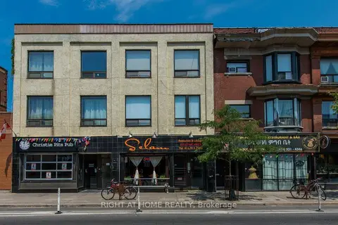
$2,998,000
11 ba
812 Bloor Street W
Dovercourt-Wallace Emerson-Junction, Toronto
Store W Apt/Office · MLS® W13750568 · RIGHT AT HOME REALTY
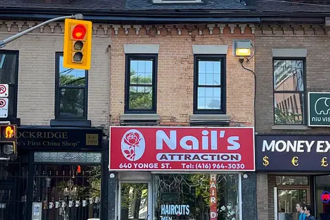
$2,500,000
Reduced $350,000
640 Yonge Street
Bay Street Corridor, Toronto
Commercial Retail · MLS® C13247254 · RIGHT AT HOME REALTY
$2,500,000
447 Church Street
Church-Yonge Corridor, Toronto
Commercial Retail · MLS® C13769496 · SKYBOUND REALTY
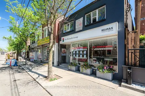
$2,500,000
1945 Queen Street E
The Beaches, Toronto
Store W Apt/Office · MLS® E13233626 · RE/MAX ULTIMATE REALTY INC.
$2,500,000
3 ba
3369 Lake Shore Boulevard W
Long Branch, Toronto
Commercial Retail · MLS® W13025612 · SUTTON GROUP-TOWER REALTY LTD.
$2,500,000
151 Roncesvalles Avenue
Roncesvalles, Toronto
Store W Apt/Office · MLS® W14087314 · REMAX YOUR COMMUNITY REALTY
$2,499,000
Reduced $139,000
422 Queen Street W
Kensington-Chinatown, Toronto
Commercial Retail · MLS® C12701700 · HOMELIFE LANDMARK REALTY INC.