200 Bathurst Street
Trinity-Bellwoods, Toronto, M5T 2R8
$799,000
- 4 bathrooms
Listed 24 days ago · MLS® C13830350
About this home
** Attention investors & business owners ** Positioned at the edge of Toronto's vibrant Fashion District, this two story mixed use commercial building offers a rare opportunity comprised of a blank canvas for a commercial space, along with a recently renovated two bedroom residential unit on the second floor. One of the most unique advantages with this property is the two parking spaces in tandem located off of Wolseley St to the north. In addition there is a standalone garage behind the building which acts as a secondary storage space completely separate of the primary structure. Seconds from Queen West, this property benefits from exceptional pedestrian traffic, strong transit access, and a lively streetscape known for its boutiques, galleries, and creative energy. Whether for retail, office, or residential use, 200 Bathurst Street delivers unmatched exposure in one of Toronto's most sought-after live-work-play corridors. *Property under Power of Sale.*
Details
- Type
- Commercial Retail
- Lot
- 20 × 109 ft
- Garage
- Lane
- Property tax
- $19,762 (2025)
- Neighbourhood
- Trinity-Bellwoods
- Municipality
- Toronto C01
Interior
- Bathrooms
- 4 × bathroom
Heating, cooling and services
- Heating
- Gas Forced Air Open
- Air conditioning
- Partial
- Utilities
- Yes
Building and exterior
- Building area
- 2,135 Square Feet
More
- Possession
- Immediate
- Cross street
- Bathurst & Queen
History of this address
2 earlier listings at this address, with sold and leased prices. Create a free account or sign in to see them.
Location
Location is approximate. See nearby homes on the map
Recent sales nearby
See what similar homes within 1 km sold for in the last year. Create a free account or sign in to see them.
The neighbourhood
Getting around Very walkable
- 🚇 Osgoode Subway1.5 km
- 🚇 St. Patrick Subway1.5 km
- 🚆 Exhibition GO1.8 km
Within a 10-minute walk: 20 grocery stores, 383 cafés and restaurants, 15 parks, 21 pharmacies. Nearest grocery: Queens Fruit Market & Plants (100 m). Nearest park: Portland Street Parkette (300 m).
Schools nearby
Elementary
- St. Mary Catholic School Catholic
EQAO: Gr 6 reading 100%, math 38%4 min walk - Ryerson Community School
EQAO: Gr 6 reading 65%, math 26%6 min walk - Charles G Fraser Junior Public School
EQAO: Gr 6 reading 95%, math 71%6 min walk - Niagara Street Junior Public School
EQAO: Gr 6 reading 100%, math 84%8 min walk
Secondary
- Downtown Vocal Music Academy of Toronto Private6 min walk
- Oasis Alternative Secondary School9 min walk
EQAO: share of students meeting the provincial standard (2024–25). Ontario average: Gr 6 reading 86%, math 51%; Gr 9 math 55%; literacy test 83%.
Closest schools, not school zones. Check which school serves this address with the school board before relying on it.
Who lives here postal area M5T
- Owners / renters
- 32% / 68%
- Median household income
- $61,600
- Average age
- 42
- Children under 15
- 7%
- Homes
- 1% detached, 56% high-rise
- Commute by transit
- 24%
- Population
- 17,903
Languages spoken most at home besides English: Mandarin 10.4%, Yue (Cantonese) 9.2%, Vietnamese 1.3%, Spanish 1%.
Flood and conservation No mapped hazard
Not inside a mapped flood plain or regulated area.
Screening maps only. Ask the conservation authority for a property inquiry before relying on this.
Safety
Major crime per resident in Trinity-Bellwoods (2025): about the Toronto average, down 17% from the year before.
- Assault23% above average
- Break and enter85% above average
- Auto theft66% below average
- Robbery26% below average
- Theft from vehicles33% above average
- Shootings28% below average
Crime Severity Index for Toronto police: 60 vs 57 for Ontario (2025).
Police-reported figures for the whole neighbourhood, not this street. Rates use the area’s resident population.
Development nearby 18 active
-
689 KING ST W · 500 mOfficial Plan / Zoning By-law Amendment · Application Received · applied 2026Proposed 30-storey mixed-use development, comprised of hotel uses on the first 13-storeys, including a restaurant and 251 hotel suites, and residential uses…Application details
-
451 ADELAIDE ST W · 450 mOfficial Plan / Zoning By-law Amendment · Appeal Received · applied 2025Zoning By-law Amendment for a 17-storey (59.65m including mechanical penthouse) hotel containing 144 suites.Application details
-
668 KING ST W · 450 mSite Plan · Under Review · applied 2023Ontario Line King-BathurstApplication details
-
723 QUEEN ST W · 250 mSite Plan · NOAC Issued · applied 2022To demolish the existing two-storey, 60-bed crisis shelter building and construct a new four-storey shelter building with 63 beds and a total gross floor area…Application details
-
689 KING ST W · 500 mSite Plan · Under Review · applied 2022To construct 11 and 18 storey hotel with 272 suites and a restaurant at-grade. Related applications include zoning by-law amendment application 19 115906 STE…Application details
-
675 KING ST W · 500 mSite Plan · Under Review · applied 2022The proposed development is for a 19-storey mixed-use building with a height of approximately 67.7 metres to the top of the roof (72.0 metres to the top of the…Application details
16 more within 500 m.
Rezoning, site plan, subdivision and condominium applications filed with the city.
Distances are approximate. Places © OpenStreetMap contributors. Neighbourhood figures: Statistics Canada, 2021 Census. School results: EQAO via Ontario Data Catalogue (Open Government Licence – Ontario). Neighbourhood crime: Toronto Police Service Public Safety Data Portal (Open Government Licence – Toronto Police Service). Crime Severity Index: Statistics Canada. Planning applications: City of Toronto open data.
Living here
Commute
To Union Station (downtown Toronto): 2 km. Transit times · Driving times
Coming transit
- 🚧 King West GO Transit450 m
- 🚧 Chinatown 650 m
- 🚧 Osgoode 1.4 km
Stations under construction or approved. Opening dates are the latest public estimates and often move.
Noise Nothing major nearby
No highway within 500 m, rail line within 300 m, or airport flight path nearby.
Distances from the map, not noise measurements. Visit at rush hour to judge for yourself.
Building permits
No building permits at this address since 2014.
1 permit on this block of the street in the last 2 years.
Permits filed with the City of Toronto. A permit doesn’t mean the work passed final inspection.
Trees
29 City street trees within 100 m, mostly maples. That’s fewer than the Toronto average of 42.
Trees on City boulevards only, not private yards or parks.
Internet High-speed
50/10 Mbps or faster available here by cable, fibre or DSL (the federal high-speed target).
From the federal broadband map. Check exact speeds and providers for the address.
Zoning, heritage, building permits and street trees: City of Toronto open data (Open Government Licence – Toronto). Roads, rail, airports and planned stations © OpenStreetMap contributors. Internet: Innovation, Science and Economic Development Canada, National Broadband Data.
Listed by RARE REAL ESTATE.
Listing information provided by PropTx Innovations Inc. and TRREB; deemed reliable but not guaranteed accurate by PropTx.
Similar homes nearby
See more in Toronto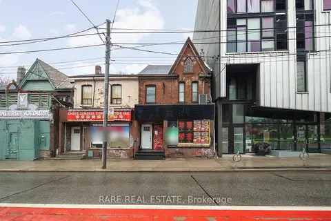
$799,000
4 ba
200 Bathurst Street
Trinity-Bellwoods, Toronto
Investment · MLS® C13830344 · RARE REAL ESTATE
$799,000
3 ba
2450 Victoria Park Avenue 100A
Henry Farm, Toronto
Sale Of Business · MLS® C12875344 · CENTERPOINT REALTY INC.
$799,000
Reduced $31,000
15 Wellesley Street W 318-319
Bay Street Corridor, Toronto
Office · MLS® C13775884 · T-ONE GROUP REALTY INC.,
$799,000
1 ba
2370 Midland Avenue B8
Agincourt South-Malvern West, Toronto
Commercial Retail · MLS® E13230288 · HOMELIFE DISTRICT REALTY
$799,000
2 ba
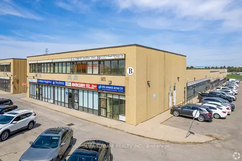
80 Nashdene Road 81
Milliken, Toronto
Industrial · MLS® E13551192 · HOMELIFE/FUTURE REALTY INC.
$799,000
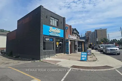
2187 Weston Road
Weston, Toronto
Commercial Retail · MLS® W13647814 · REMAX YOUR COMMUNITY REALTY
$799,900
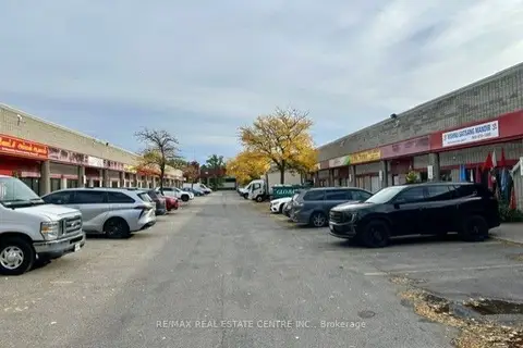
328 Passmore Avenue 15
Milliken, Toronto
Industrial · MLS® E13863292 · RE/MAX REAL ESTATE CENTRE INC.
$800,000
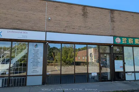
50 Weybright Court 19
Agincourt South-Malvern West, Toronto
Industrial · MLS® E13790280 · HOMELIFE LANDMARK REALTY INC.