138 Anderson Avenue 7-10
Greensborough, Markham, L6E 1A4
$19/mo
- 5 bathrooms
Listed 22 days ago · MLS® N13834118
About this home
Beautifully built-out offices PLUS very functional warehouse with one truck level and two drive-in doors. 2 full and 2 partial units combined together and listed as one - please see attached floor plans. Very versatile space with various configurations for office and/or warehouse space. Four front facing doors. Current Office is 5,745sqft and Warehouse is 2,272sqft. Warehouse has 16'clear height. Large open finished space of 800sqft also has 16' clear height (labeled Room A on the floor plans). All office except of Room A is airconditioned. Please note on the floor plans attached that the walls highlighted in BLUE may be removed to convert the current office space back to warehouse use and enlarge the Warehouse an additional 1,500sgft for a total of over 3,750sqft of warehouse and apprx 4,268sqft of office. Location is amazing walking distance apprx 250m) from the Mont Joy Go station as well as the many shops and restaurants and such. Less than 5km from HWY 407.
Details
- Type
- Industrial
- Garage
- None
- Property tax
- $7 (2026)
- Neighbourhood
- Greensborough
- Municipality
- Markham
Interior
- Bathrooms
- 5 × bathroom
Heating, cooling and services
- Heating
- Gas Forced Air Closed
- Air conditioning
- Partial
- Utilities
- Yes
Building and exterior
- Building area
- 8,018 Square Feet
Rental terms
- Minimum term
- 24 months
More
- Possession
- Flexible
- Cross street
- Bur Oak & Markham Rd
- Business type
- Warehouse
Location
Location is approximate. See nearby homes on the map
The neighbourhood
Getting around Walkable
- 🚆 Mount Joy GO3 min walk
Within a 10-minute walk: 2 grocery stores, 19 cafés and restaurants, 10 parks, 1 pharmacy. Nearest grocery: Food Basics (550 m). Nearest park: James Thomas Park (600 m).
Schools nearby
Elementary
- Mount Joy Public School
EQAO: Gr 6 reading 97%, math 77%8 min walk - Ace Montessori Private9 min walk
- Wismer Public School
EQAO: Gr 6 reading 96%, math 75%14 min walk - St. Julia Billiart Catholic Elementary School Catholic
EQAO: Gr 6 reading 98%, math 66%14 min walk
Secondary
- St. Brother André Catholic High School Catholic
EQAO: Gr 9 math 69%, literacy test 94%13 min walk - Bur Oak Secondary School
EQAO: Gr 9 math 89%, literacy test 96%1.3 km
EQAO: share of students meeting the provincial standard (2024–25). Ontario average: Gr 6 reading 86%, math 51%; Gr 9 math 55%; literacy test 83%.
Closest schools, not school zones. Check which school serves this address with the school board before relying on it.
Who lives here postal area L6E
- Owners / renters
- 87% / 13%
- Median household income
- $115,000
- Average age
- 39
- Children under 15
- 19%
- Homes
- 55% detached, 6% high-rise
- Commute by transit
- 9%
- Population
- 38,387
Languages spoken most at home besides English: Yue (Cantonese) 18.4%, Mandarin 12.4%, Tamil 3.9%, Urdu 1%.
Flood and conservation Flood plain
This address falls inside a mapped flood plain (Toronto and Region Conservation Authority). Building, additions and grading need a permit from the conservation authority, and flood insurance can cost more or be harder to get.
Screening maps only. Ask the conservation authority for a property inquiry before relying on this.
Safety
Crime Severity Index for York Region police: 50 vs 57 for Ontario (2025).
Police-reported figures for the whole police service area, not this street. Rates use the area’s resident population.
Distances are approximate. Places © OpenStreetMap contributors. Neighbourhood figures: Statistics Canada, 2021 Census. School results: EQAO via Ontario Data Catalogue (Open Government Licence – Ontario). Flood and regulation mapping: Toronto and Region Conservation Authority open data. Crime Severity Index: Statistics Canada.
Living here
Commute
To Union Station (downtown Toronto): 30 km. Transit times · Driving times
Noise 1 source nearby
- 🚆 Rail line (Uxbridge Subdivision)150 m
Distances from the map, not noise measurements. Visit at rush hour to judge for yourself.
Internet High-speed
50/10 Mbps or faster available here by cable, fibre or DSL (the federal high-speed target).
From the federal broadband map. Check exact speeds and providers for the address.
Roads, rail, airports and planned stations © OpenStreetMap contributors. Internet: Innovation, Science and Economic Development Canada, National Broadband Data.
Listed by REMAX YOUR COMMUNITY REALTY.
Listing information provided by PropTx Innovations Inc. and TRREB; deemed reliable but not guaranteed accurate by PropTx.
Similar homes nearby
See more in Markham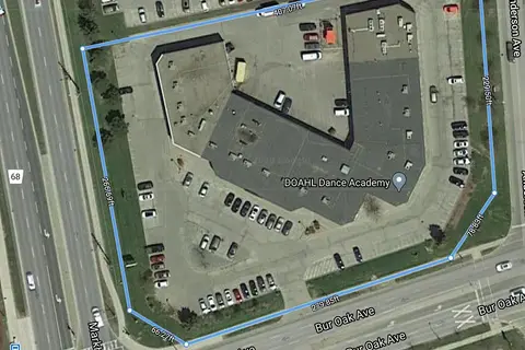
$21/mo
1 ba
50 Anderson Avenue 8
Greensborough, Markham
Industrial · MLS® N13647998 · SKYLETTE MARKETING REALTY INC.
$23/mo
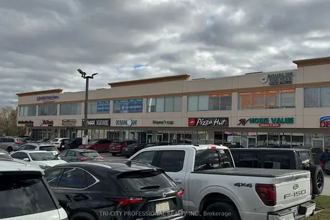
9889 Markham Road 204
Greensborough, Markham
Office · MLS® N13630778 · TRI-CITY PROFESSIONAL REALTY INC.
$19/mo
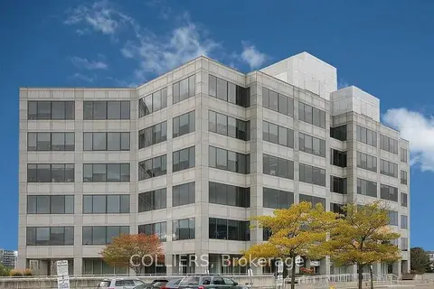
175 Commerce Valley Drive W 230
Commerce Valley, Markham
Office · MLS® N5535418 · COLLIERS
$19/mo
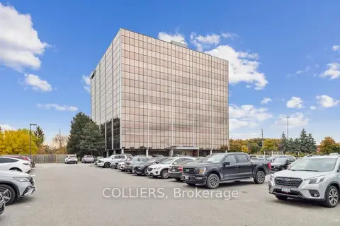
7030 Woodbine Avenue 203
Milliken Mills West, Markham
Office · MLS® N11881498 · COLLIERS
$19/mo
7050 Woodbine Avenue 307
Milliken Mills West, Markham
Office · MLS® N12178414 · COLLIERS
$19/mo
7030 Woodbine Avenue 600
Milliken Mills West, Markham
Office · MLS® N12456291 · COLLIERS
$19/mo
7100 Woodbine Avenue 403
Milliken Mills West, Markham
Office · MLS® N12536186 · COLLIERS
$19/mo
2705 Elgin Mills Road E BLDG B #1-4
Cathedraltown, Markham
Industrial · MLS® N12551150 · TRINIHILL REALTY CORP.