1027 Coxwell Avenue
East York, Toronto, M4C 3G4
$115,000
- 3 bathrooms
Listed yesterday · MLS® E14093314
About this home
Move Right Into A Fully Equipped Quick-Service Restaurant Spot On A Highly Active Coxwell Ave Commercial Strip. Operating On An Attractive Gross Rent Basis, This Location Features Budget-Friendly Rent Designed To Keep Overhead Low. The Space Boasts Versatile Infrastructure That Can Be Easily Rebranded To Any Fast-Casual, Takeout, Bakery, Dessert, Or Grab-And-Go Concept. The Functional Main Floor Layout Includes A Full Commercial Kitchen With An Exhaust Hood And A Washroom. The Basement Offers Massive Storage Capacity, A Dedicated Food Prep Area, And Additional Washrooms. Zoned For Any Food Style Or Cuisine, The Tenant May Apply For A Liquor License. All Chattels Are Included. Exterior Perks Include Highly Desirable Out-Front Patio Seating And Two Dedicated Car Parking Spaces At The Rear With Convenient Lane Access.
Details
- Type
- Sale Of Business
- Lot
- 20 × 115 ft
- Garage
- Outside/Surface
- Neighbourhood
- East York
- Municipality
- Toronto E03
Interior
- Bathrooms
- 3 × bathroom
Heating, cooling and services
- Heating
- Gas Forced Air Closed
- Air conditioning
- Yes
- Water and sewer
- Sanitary
- Utilities
- Yes
Building and exterior
- Building area
- 1,100 Sq Ft Divisible
More
- Possession
- TDB
- Cross street
- O'Conner
- Business type
- Restaurant
Location
Location is approximate. See nearby homes on the map
Recent sales nearby
See what similar homes within 1 km sold for in the last year. Create a free account or sign in to see them.
The neighbourhood
Getting around Walkable
- 🚇 Coxwell Subway1.5 km
- 🚇 Greenwood Subway1.6 km
- 🚆 Danforth GO2.6 km
Within a 10-minute walk: 1 grocery store, 9 cafés and restaurants, 6 parks, 2 pharmacies. Nearest grocery: Wayne's Supermarket (50 m). Nearest park: Cullen Bryant Park (350 m).
Schools nearby
Elementary
- Diefenbaker Elementary School
EQAO: Gr 3 reading 71%, math 65%5 min walk - Canadian Martyrs Catholic School Catholic
EQAO: Gr 6 reading 88%, math 54%12 min walk - R H McGregor Elementary School
EQAO: Gr 3 reading 72%, math 74%14 min walk - Parkside Elementary School
EQAO: Gr 3 reading 86%, math 62%16 min walk
Secondary
- East York Collegiate Institute
EQAO: Gr 9 math 46%, literacy test 83%4 min walk - Cosburn Middle School6 min walk
- East York Alternative Secondary School6 min walk
EQAO: share of students meeting the provincial standard (2024–25). Ontario average: Gr 6 reading 86%, math 51%; Gr 9 math 55%; literacy test 83%.
Closest schools, not school zones. Check which school serves this address with the school board before relying on it.
Who lives here postal area M4C
- Owners / renters
- 53% / 47%
- Median household income
- $83,000
- Average age
- 40
- Children under 15
- 17%
- Homes
- 27% detached, 38% high-rise
- Commute by transit
- 37%
- Population
- 46,440
Languages spoken most at home besides English: Bengali 4.3%, Yue (Cantonese) 2.1%, Urdu 1.4%, Tagalog (Pilipino, Filipino) 0.9%.
Flood and conservation No mapped hazard
Not inside a mapped flood plain or regulated area.
Screening maps only. Ask the conservation authority for a property inquiry before relying on this.
Safety
Major crime per resident in Old East York (2025): about the Toronto average, down 6% from the year before.
- Assaultabout average
- Break and enter48% below average
- Auto theftabout average
- Robbery24% below average
- Theft from vehicles27% above average
- Shootings22% above average
Crime Severity Index for Toronto police: 60 vs 57 for Ontario (2025).
Police-reported figures for the whole neighbourhood, not this street. Rates use the area’s resident population.
Development nearby
No planning applications within 500 m in the last five years.
Rezoning, site plan, subdivision and condominium applications filed with the city.
Distances are approximate. Places © OpenStreetMap contributors. Neighbourhood figures: Statistics Canada, 2021 Census. School results: EQAO via Ontario Data Catalogue (Open Government Licence – Ontario). Neighbourhood crime: Toronto Police Service Public Safety Data Portal (Open Government Licence – Toronto Police Service). Crime Severity Index: Statistics Canada.
Living here
Commute
To Union Station (downtown Toronto): 7 km. Transit times · Driving times
Coming transit
- 🚧 Cosburn 1.8 km
- 🚧 Thorncliffe Park 1.9 km
Stations under construction or approved. Opening dates are the latest public estimates and often move.
Noise Nothing major nearby
No highway within 500 m, rail line within 300 m, or airport flight path nearby.
Distances from the map, not noise measurements. Visit at rush hour to judge for yourself.
What can be built CR
Commercial Residential (with a site-specific exception).
From Toronto’s Zoning By-law 569-2013 map. Lot size, setbacks and trees decide what actually fits; check with a planner before you buy.
Trees
33 City street trees within 100 m, mostly maples. That’s about the Toronto average of 42.
Trees on City boulevards only, not private yards or parks.
Internet High-speed
50/10 Mbps or faster available here by cable, fibre or DSL (the federal high-speed target).
From the federal broadband map. Check exact speeds and providers for the address.
Zoning, heritage, building permits and street trees: City of Toronto open data (Open Government Licence – Toronto). Roads, rail, airports and planned stations © OpenStreetMap contributors. Internet: Innovation, Science and Economic Development Canada, National Broadband Data.
Listed by RE/MAX ULTIMATE REALTY INC..
Listing information provided by PropTx Innovations Inc. and TRREB; deemed reliable but not guaranteed accurate by PropTx.
Similar homes nearby
See more in Toronto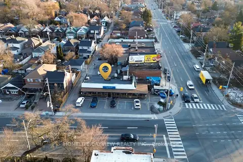
$129,000
Reduced $146,000
Address withheld · East York
East York, Toronto
Sale Of Business · MLS® E12644444 · HOMELIFE/BAYVIEW REALTY INC.

$115,000
Reduced $60,000
615 King Street W
Waterfront Communities C1, Toronto
Sale Of Business · MLS® C13250188 · HOMELIFE LANDMARK REALTY INC.
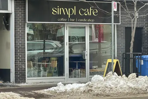
$115,000
799 College Street 101
Trinity-Bellwoods, Toronto
Sale Of Business · MLS® C13740610 · REMAX YOUR COMMUNITY REALTY

$118,000
Reduced $70,000
2301 Brimley Road 136
Agincourt North, Toronto
Sale Of Business · MLS® E12863806 · YOUR HOME SOLD GUARANTEED REALTY SPECIALISTS INC
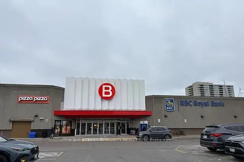
$118,000
Reduced $40,000
1 ba
2900 Warden Avenue 152
L'Amoreaux, Toronto
Sale Of Business · MLS® E13114578 · BAY STREET INTEGRITY REALTY INC.
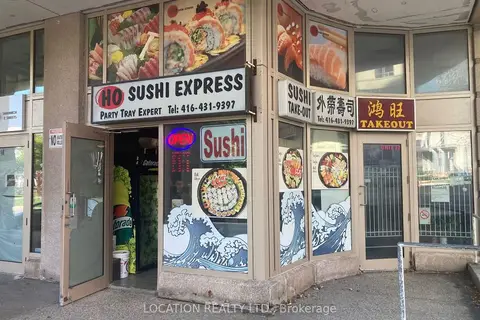
$118,000
28 Lee Centre Drive
Woburn, Toronto
Sale Of Business · MLS® E13775746 · LOCATION REALTY LTD.
$118,300
1 ba
96 Gerrard Street E
Church-Yonge Corridor, Toronto
Sale Of Business · MLS® C13861110 · LSG REALTY INC.
$119,000
5 bd2 ba
680 Queen Street W
Trinity-Bellwoods, Toronto
Sale Of Business · MLS® C13712376 · KW Living Realty