550 Industrial Drive
1034 - MN Milton North, Milton, L9T 5E1
$14/mo
Listed 192 days ago · MLS® W12983816
About this home
134,044 sq ft industrial facility available for lease in a prime Milton location, offering high power capability and excellent access to Highway 401 and surrounding amenities. The building features a 24' clear height, 14 truck-level doors, and 3 drive-in doors, providing strong shipping functionality and flexibility for a range of users. A well-maintained and highly efficient facility ideally suited for manufacturing, warehousing, or distribution operations.
Details
- Type
- Industrial
- Lot
- 252 × 723 ft
- Garage
- Outside/Surface
- Property tax
- $2 (2026)
- Neighbourhood
- 1034 - MN Milton North
- Municipality
- Milton
Heating, cooling and services
- Heating
- Gas Forced Air Open
- Air conditioning
- Partial
- Water and sewer
- Sanitary+Storm
- Utilities
- Yes
Building and exterior
- Building area
- 135,044 Square Feet
Rental terms
- Minimum term
- 60 months
More
- Possession
- January 1st, 2027
- Cross street
- Industrial Drive & Market Drive
- Business type
- Warehouse
Location
Location is approximate. See nearby homes on the map
The neighbourhood
Getting around Car-dependent
- 🚆 Milton GO3.2 km
Within a 10-minute walk: no grocery stores, 5 cafés and restaurants, 1 park. Nearest park: Chris Hadfield Park (950 m).
Schools nearby
Elementary
- Martin Street Public School
EQAO: Gr 6 reading 91%, math 44%1.4 km - Holy Rosary Catholic Elementary School Catholic
EQAO: Gr 6 reading 88%, math 40%1.6 km - Stirling Montessori Academy Private1.7 km
- Tarbiyah Elementary School Private2.2 km
Secondary
- W. I. Dick Middle School1.5 km
EQAO: share of students meeting the provincial standard (2024–25). Ontario average: Gr 6 reading 86%, math 51%; Gr 9 math 55%; literacy test 83%.
Closest schools, not school zones. Check which school serves this address with the school board before relying on it.
Who lives here postal area L9T
- Owners / renters
- 83% / 17%
- Median household income
- $126,000
- Average age
- 35
- Children under 15
- 24%
- Homes
- 53% detached, 6% high-rise
- Commute by transit
- 4%
- Population
- 110,956
Languages spoken most at home besides English: Urdu 6.1%, Arabic 2.2%, Spanish 1.5%, Punjabi (Panjabi) 1.1%.
Flood and conservation No mapped hazard
Not inside a mapped flood plain or regulated area in Credit Valley Conservation’s mapping.
Screening maps only. Ask the conservation authority for a property inquiry before relying on this.
Safety
Crime Severity Index for Halton Region (Oakville/Burlington) police: 31 vs 57 for Ontario (2025).
Police-reported figures for the whole police service area, not this street. Rates use the area’s resident population.
Distances are approximate. Places © OpenStreetMap contributors. Neighbourhood figures: Statistics Canada, 2021 Census. School results: EQAO via Ontario Data Catalogue (Open Government Licence – Ontario). Flood and regulation mapping: Credit Valley Conservation open data. Crime Severity Index: Statistics Canada.
Living here
Commute
To Union Station (downtown Toronto): 45 km. Transit times · Driving times
Noise Nothing major nearby
No highway within 500 m, rail line within 300 m, or airport flight path nearby.
Distances from the map, not noise measurements. Visit at rush hour to judge for yourself.
Internet High-speed
50/10 Mbps or faster available here by cable, fibre or DSL (the federal high-speed target).
From the federal broadband map. Check exact speeds and providers for the address.
Roads, rail, airports and planned stations © OpenStreetMap contributors. Internet: Innovation, Science and Economic Development Canada, National Broadband Data.
Listed by COLLIERS.
Listing information provided by PropTx Innovations Inc. and TRREB; deemed reliable but not guaranteed accurate by PropTx.
Similar homes nearby
See more in Milton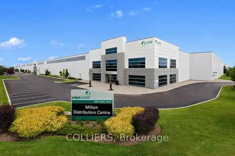
$16/mo
2750 Peddie Road 101
1034 - MN Milton North, Milton
Industrial · MLS® W13826102 · COLLIERS

$15/mo
875 Main Street E 201
1031 - DP Dorset Park, Milton
Office · MLS® W13823866 · HOMELIFE SILVERCITY REALTY INC.

$17/mo
585 Ontario St S Street 204
1037 - TM Timberlea, Milton
Office · MLS® W13808014 · ROYAL LEPAGE WEST REALTY GROUP LTD.