55 Lebovic Avenue C114 & C115 (Ground Flr)
Clairlea-Birchmount, Toronto, M1L 0H2
$45/mo
Listed 4 days ago · MLS® E14084306
About this home
Rare Opportunity to Lease 2642 SQFT (Rentable Area) in High Demand Retail (Food Plaza) with Approved Zoning of Dine-In Restaurant of 90 Seatings located in a High-Traffic Area at Popular Shopping District Of Scarborough at Highly Sought after Location of Warden Ave & Eglinton Ave E. in One of busiest retail hubs with Ample Parking and Excellent Exposure. Vibrant Area With Great Tenants Include D-Spot, Affy's Premium Grill, Chachi's Chai, Karachi Express, Chaiiwala of London, Pizza Karachi, Oodles Wok, Burger Alley, Coco, Food Court Outlets, Professional & Medical Offices including Dental Office and Insurance Offices. This property is surrounded by major retailers like Walmart, Canadian Tire, Lowes, RONA, Cineplex, Banks, and is Steps to the new Eglinton Crosstown LRT. Positioned in a rapidly growing area with over 35,000 new residential units planned, this is an ideal opportunity for Owner Operators, entrepreneurs, and professionals seeking high visibility, steady foot traffic, and long-term growth potential. Once Centre Plaza is the Destination Hub & Office Location For Customers & Professionals surrounded by Ontario Court Houses, Banks, Grocery, Clothing & Hardware Stores, and Entertainment Centers. Few Minutes Drive to Highways Highways 401 & DVP. TMI is $16 per SQFT in addition to net rent.
Details
- Type
- Commercial Retail
- Garage
- Outside/Surface
- Property tax
- $11,392 (2025)
- Neighbourhood
- Clairlea-Birchmount
- Municipality
- Toronto E04
Heating, cooling and services
- Heating
- Gas Forced Air Open
- Air conditioning
- Yes
- Utilities
- Available
Building and exterior
- Building area
- 2,642 Square Feet
Rental terms
- Minimum term
- 12 months
More
- Possession
- 30/60/TBA
- Cross street
- Warden Ave & Eglinton Ave E.
Location
Location is approximate. See nearby homes on the map
The neighbourhood
Getting around Very walkable
- 🚇 Hakimi Lebovic LRT4 min walk
- 🚇 Golden Mile LRT7 min walk
- 🚆 Kennedy GO2.4 km
Within a 10-minute walk: 9 grocery stores, 36 cafés and restaurants, 5 parks, 1 pharmacy. Nearest grocery: Bulk Barn (100 m). Nearest park: Ashtonbee Reservoir Park (800 m).
Schools nearby
Elementary
- Clairlea Public School
EQAO: Gr 6 reading 74%, math 30%16 min walk - General Brock Public School
EQAO: Gr 6 reading 76%, math 27%1.4 km - O'Connor Public School
EQAO: Gr 3 reading 55%, math 32%1.4 km - Victoria Park Elementary School
EQAO: Gr 3 reading 100%, math 92%1.5 km
Secondary
- W. A. Porter Collegiate Institute
EQAO: Gr 9 math 61%, literacy test 89%14 min walk
EQAO: share of students meeting the provincial standard (2024–25). Ontario average: Gr 6 reading 86%, math 51%; Gr 9 math 55%; literacy test 83%.
Closest schools, not school zones. Check which school serves this address with the school board before relying on it.
Who lives here postal area M1L
- Owners / renters
- 51% / 49%
- Median household income
- $78,000
- Average age
- 40
- Children under 15
- 17%
- Homes
- 27% detached, 34% high-rise
- Commute by transit
- 35%
- Population
- 35,833
Languages spoken most at home besides English: Bengali 8%, Tagalog (Pilipino, Filipino) 2.6%, Urdu 2.1%, Yue (Cantonese) 2%.
Flood and conservation No mapped hazard
Not inside a mapped flood plain or regulated area.
Screening maps only. Ask the conservation authority for a property inquiry before relying on this.
Safety
Major crime per resident in Clairlea-Birchmount (2025): 45% above the Toronto average, about the same from the year before.
- Assault70% above average
- Break and enterabout average
- Auto theft28% above average
- Robbery38% below average
- Theft from vehicles37% above average
- Shootings20% above average
Crime Severity Index for Toronto police: 60 vs 57 for Ontario (2025).
Police-reported figures for the whole neighbourhood, not this street. Rates use the area’s resident population.
Development nearby 24 active
-
1891 EGLINTON AVE E · 450 mSite Plan · Under Review · applied 2022Application details
-
1891 EGLINTON AVE E · 450 mSite Plan · Under Review · applied 2022Site Plan Control application to permit Phase 1 of the development at 1891 Eglinton Ave E, which will consist of two mixed-use buildings on the northwest…Application details
-
1891 EGLINTON AVE E · 450 mSite Plan · Under Review · applied 2022Application details
-
1891 EGLINTON AVE E · 450 mSite Plan · Under Review · applied 2022Application details
-
1900 EGLINTON AVE E · 450 mOfficial Plan / Zoning By-law Amendment · Under Review · applied 2022Zoning By-law Amendment for Phase 2 of the proposed development at 1900 Eglinton Ave E to permit a mixed-use development consisting of three (3) tall buildings…Application details
-
1900 EGLINTON AVE E · 450 mPlan of Subdivision · Under Review · applied 2022Draft Plan of Subdivision application to create 10 blocks to permit a mixed-use development on the lands at 1900 Eglinton Ave E (Calloway/SmartCentres),…Application details
20 more within 500 m.
Rezoning, site plan, subdivision and condominium applications filed with the city.
Distances are approximate. Places © OpenStreetMap contributors. Neighbourhood figures: Statistics Canada, 2021 Census. School results: EQAO via Ontario Data Catalogue (Open Government Licence – Ontario). Neighbourhood crime: Toronto Police Service Public Safety Data Portal (Open Government Licence – Toronto Police Service). Crime Severity Index: Statistics Canada. Planning applications: City of Toronto open data.
Living here
Commute
To Union Station (downtown Toronto): 11 km. Transit times · Driving times
Noise Nothing major nearby
No highway within 500 m, rail line within 300 m, or airport flight path nearby.
Distances from the map, not noise measurements. Visit at rush hour to judge for yourself.
Building permits
- Interior Alterations · 2026 · Permit IssuedProposal for interior alterations for a change of use from office to take-out restaurant.
- Interior Alterations · 2025 · ClosedINTERIOR ALTERATIONS TO UNIT C111CONVERSION FROM RETAIL TO TAKE-OUT RESTAURANT
- Interior Alterations · 2023 · ClosedInterior alterations to ground floor - restaurant, and addition of 2nd floor for office use - unit unit C104 and C105
- Interior Alterations · 2022 · ClosedRev 02 - Revision - cooking equipment, ceiling layout and revised exhaust canopy.Rev 01 - Revision to cooking equipment/ceiling layout, and…
- Interior Alterations · 2020 · InspectionProposed interior alterations to convert existing vacant unit into retail use- (C109).
7 permits on this block of the street in the last 2 years.
Permits filed with the City of Toronto. A permit doesn’t mean the work passed final inspection.
Trees
33 City street trees within 100 m, mostly maples. That’s about the Toronto average of 42.
Trees on City boulevards only, not private yards or parks.
Internet High-speed
50/10 Mbps or faster available here by cable, fibre or DSL (the federal high-speed target).
From the federal broadband map. Check exact speeds and providers for the address.
Zoning, heritage, building permits and street trees: City of Toronto open data (Open Government Licence – Toronto). Roads, rail, airports and planned stations © OpenStreetMap contributors. Internet: Innovation, Science and Economic Development Canada, National Broadband Data.
Listed by WORLD CLASS REALTY POINT.
Listing information provided by PropTx Innovations Inc. and TRREB; deemed reliable but not guaranteed accurate by PropTx.
Similar homes nearby
See more in Toronto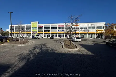
$45/mo
69 Lebovic Avenue D109
Clairlea-Birchmount, Toronto
Commercial Retail · MLS® E13872292 · WORLD CLASS REALTY POINT
$45/mo
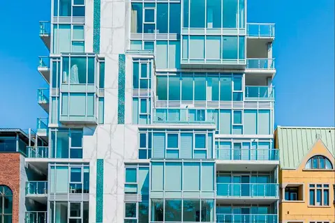
346 Davenport Road Retail (Main)
Annex, Toronto
Commercial Retail · MLS® C12085729 · PSR
$45/mo
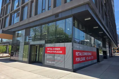
54 Power Street 110
Moss Park, Toronto
Commercial Retail · MLS® C13175296 · THE BEHAR GROUP REALTY INC.
$45/mo
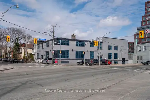
8 Eastern Avenue Second Floor
Moss Park, Toronto
Commercial Retail · MLS® C13202738 · Nucorp Realty International
$45/mo
8 Eastern Avenue Ground + Second
Moss Park, Toronto
Commercial Retail · MLS® C13202744 · Nucorp Realty International
$45/mo
8 Eastern Avenue Ground
Moss Park, Toronto
Commercial Retail · MLS® C13202788 · Nucorp Realty International
$45/mo
75 Huntley Street
North St. James Town, Toronto
Office · MLS® C13415220 · AVISON YOUNG COMMERCIAL REAL ESTATE SERVICES, LP
$45/mo
1 bd2 ba
819 Dundas Street W
Trinity-Bellwoods, Toronto
Commercial Retail · MLS® C13571922 · HARVEY KALLES REAL ESTATE LTD.