4949 VICTORIA Avenue
211 - Cherrywood, Niagara Falls, L2E 4C7
$2,800/mo
- 1 bathrooms
Listed 14 days ago · MLS® X13868998
About this home
RemarksPublic Remarks: Bring your vision to life at 4949 Victoria Ave! A unique and versatile commercial space offering approximately 2,610 sq. ft. of total usable area in a prime Niagara Falls location, just minutes from the Falls, Clifton Hill, hotels, major attractions and highway access. The space offers a 667 sq. ft. storefront, 377 sq. ft. garage/loading area and an impressive 1,566 sq. ft. finished lower level, giving businesses the flexibility to create something truly their own. Imagine a boutique retail concept, café or specialty food shop, wellness or beauty studio, professional office, creative studio, showroom, service business or entertainment concept. With GC zoning allowing a broad range of permitted uses, the possibilities are extensive. The unit already features a washroom, HVAC, updated electrical and lighting, plus the valuable convenience of a private garage/loading area. Whether you're launching your first location, expanding an established brand or looking for a creative space that combines customer-facing storefront with substantial additional space, this property offers an exciting canvas. $2,800/month + utilities. Bring your ideas and make this space your own! Tenant to complete their own due diligence regarding zoning and suitability for their intended use.
Details
- Type
- Commercial Retail
- Lot
- 34 × 100 ft
- Garage
- Other
- Property tax
- $1 (2026)
- Neighbourhood
- 211 - Cherrywood
- Municipality
- Niagara Falls
Interior
- Bathrooms
- 1 × bathroom
Heating, cooling and services
- Heating
- Gas Forced Air Open
- Air conditioning
- Yes
- Utilities
- Available
Building and exterior
- Building area
- 2,610 Square Feet
Rental terms
- Minimum term
- 24 months
More
- Possession
- Immediate
- Cross street
- Simcoe St/Valley Way
Location
Location is approximate. See nearby homes on the map
The neighbourhood
Getting around Walkable
No subway, LRT or GO station within a short trip.
Within a 10-minute walk: 1 grocery store, 15 cafés and restaurants, 5 parks, 1 pharmacy. Nearest grocery: Bombay Store (250 m). Nearest park: A J Mckinley Park (450 m).
Schools nearby
Elementary
- Simcoe Street Public School
EQAO: Gr 6 reading 92%, math 56%2 min walk - St. Patrick Catholic Elementary School Catholic
EQAO: Gr 3 reading 100%, math 100%7 min walk - Valley Way Public School
EQAO: Gr 6 reading 80%, math 40%11 min walk - St. Mary Catholic Elementary School Catholic
EQAO: Gr 6 reading 100%, math 100%1.4 km
Secondary
- Stamford Collegiate
EQAO: Gr 9 math 62%, literacy test 80%2.4 km
EQAO: share of students meeting the provincial standard (2024–25). Ontario average: Gr 6 reading 86%, math 51%; Gr 9 math 55%; literacy test 83%.
Closest schools, not school zones. Check which school serves this address with the school board before relying on it.
Who lives here postal area L2E
- Owners / renters
- 61% / 39%
- Median household income
- $60,800
- Average age
- 45
- Children under 15
- 13%
- Homes
- 57% detached, 7% high-rise
- Commute by transit
- 2%
- Population
- 18,587
Languages spoken most at home besides English: Italian 1.2%, Spanish 0.8%, Malayalam 0.7%, Punjabi (Panjabi) 0.6%.
Flood and conservation No mapped hazard
Not inside a mapped flood plain or regulated area in Niagara Peninsula Conservation’s mapping.
Screening maps only. Ask the conservation authority for a property inquiry before relying on this.
Safety
Crime Severity Index for Niagara Region (St. Catharines) police: 54 vs 57 for Ontario (2025).
Police-reported figures for the whole police service area, not this street. Rates use the area’s resident population.
Distances are approximate. Places © OpenStreetMap contributors. Neighbourhood figures: Statistics Canada, 2021 Census. School results: EQAO via Ontario Data Catalogue (Open Government Licence – Ontario). Flood and regulation mapping: Niagara Peninsula Conservation open data. Crime Severity Index: Statistics Canada.
Living here
Commute
To Union Station (downtown Toronto): 65 km. Transit times · Driving times
Noise Nothing major nearby
No highway within 500 m, rail line within 300 m, or airport flight path nearby.
Distances from the map, not noise measurements. Visit at rush hour to judge for yourself.
Internet High-speed
50/10 Mbps or faster available here by cable, fibre or DSL (the federal high-speed target).
From the federal broadband map. Check exact speeds and providers for the address.
Roads, rail, airports and planned stations © OpenStreetMap contributors. Internet: Innovation, Science and Economic Development Canada, National Broadband Data.
Listed by KELLER WILLIAMS COMPLETE REALTY.
Listing information provided by PropTx Innovations Inc. and TRREB; deemed reliable but not guaranteed accurate by PropTx.
Similar homes nearby
See more in Niagara Falls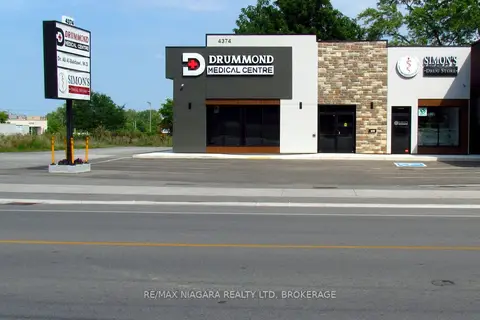
$2,500/mo
4374 DRUMMOND Road
211 - Cherrywood, Niagara Falls
Office · MLS® X12930928 · RE/MAX NIAGARA REALTY LTD, BROKERAGE
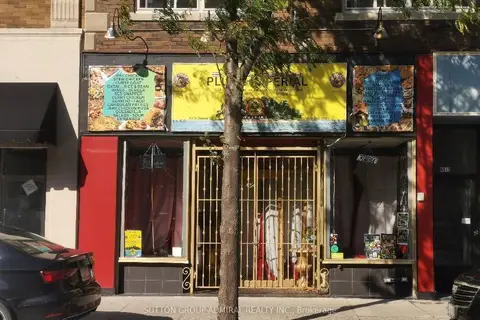
$2,890/mo
4515 Queen Street
210 - Downtown, Niagara Falls
Commercial Retail · MLS® X14085698 · SUTTON GROUP-ADMIRAL REALTY INC.
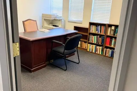
$2,471/mo
4786 Queen Street 202
210 - Downtown, Niagara Falls
Office · MLS® X13106670 · ZOLO REALTY