425 FRONT Street E 415
Waterfront Communities C8, Toronto, M5A 0X2 · More in this building
$2,300/mo
- 1 bedrooms
- 1 bathrooms
- 0 parking
- 500-599 sq ft
Listed 25 days ago · MLS® C13823476
About this home
Welcome to Urban Living at Canary House Condo. Enjoy this 1 bedroom+ den nestled in the heart of highly sought after Canary District. This suite boast off spacious long balcony with nice lay-out offering a good sized den for home office or extra bedroom space. Features high end built-in appliances, Quartz counter top, huge bathroom, ensuite laundry, and good-sized bedroom. Building offers Enjoy First Class Amenities and close proximity to groceries, streetcar, Gardiner, George Brown College, YMCA, etc.
Details
- Type
- Condo Apartment
- Style
- Apartment
- Size
- 500-599 sq ft
- Basement
- None
- Garage
- Underground
- Kitchens
- 1
- Neighbourhood
- Waterfront Communities C8
- Municipality
- Toronto C08
- Rent increase limit
- Depends on when the unit was first lived in: before Nov. 15, 2018 it’s covered by Ontario’s yearly limit (2.1% in 2026); after, there’s no cap.
Interior
- Bedrooms
- 1 above ground
- Bathrooms
- 1 × 3-piece
- Rooms
- 3 above ground
- Family room or den
- No
- Fireplace
- No
- Laundry
- In-Suite Laundry, Ensuite
- Furnished
- Unfurnished
Heating, cooling and services
- Heating
- Forced Air, Gas
- Air conditioning
- Central Air
Building and exterior
- Style
- Apartment
- Exterior
- Brick
Condo
- Balcony
- Open
- Exposure
- South
- Pets
- Yes-with Restrictions
- Property manager
- Crossbridge Property Mgmt.
Rental terms
- Rent includes
- Building Insurance, Common Elements
More
- Possession
- IMMEDIATE
- Cross street
- Front St E and Cherry St
History of this address
2 earlier listings at this address, with sold and leased prices. Create a free account or sign in to see them.
Location
Location is approximate. See nearby homes on the map
The neighbourhood
Getting around Very walkable
- 🚇 King Subway1.7 km
- 🚇 Queen Subway1.8 km
- 🚆 Toronto Union Station GO2.1 km
Within a 10-minute walk: 7 grocery stores, 73 cafés and restaurants, 21 parks, 9 pharmacies. Nearest grocery: Marché Leo’s (150 m). Nearest park: Percy Park (250 m).
Schools nearby
Elementary
- St. Paul Catholic School Catholic
EQAO: Gr 6 reading 87%, math 50%8 min walk - Market Lane Junior and Senior Public School
EQAO: Gr 6 reading 94%, math 50%11 min walk - Nelson Mandela Park Public School
EQAO: Gr 6 reading 76%, math 17%11 min walk - St. Michael Catholic School Catholic
EQAO: Gr 6 reading 83%, math 36%18 min walk
Secondary
- Inglenook Community School
EQAO: literacy test 50%3 min walk - SEED Alternative School19 min walk
- Queen Alexandra Middle School19 min walk
EQAO: share of students meeting the provincial standard (2024–25). Ontario average: Gr 6 reading 86%, math 51%; Gr 9 math 55%; literacy test 83%.
Closest schools, not school zones. Check which school serves this address with the school board before relying on it.
Who lives here postal area M5A
- Owners / renters
- 35% / 65%
- Median household income
- $71,000
- Average age
- 40
- Children under 15
- 9%
- Homes
- 0% detached, 78% high-rise
- Commute by transit
- 28%
- Population
- 48,978
Languages spoken most at home besides English: Bengali 1.8%, Mandarin 1.7%, Yue (Cantonese) 1.5%, Spanish 1.3%.
Flood and conservation No mapped hazard
Not inside a mapped flood plain or regulated area.
Screening maps only. Ask the conservation authority for a property inquiry before relying on this.
Safety
Major crime per resident in St Lawrence-East Bayfront-The Islands (2025): about the Toronto average, down 13% from the year before.
- Assault38% above average
- Break and enterabout average
- Auto theft89% below average
- Robbery23% above average
- Theft from vehicles23% below average
- Shootings45% below average
Crime Severity Index for Toronto police: 60 vs 57 for Ontario (2025).
Police-reported figures for the whole neighbourhood, not this street. Rates use the area’s resident population.
Development nearby 14 active
-
1 SUMACH ST · 200 mOfficial Plan / Zoning By-law Amendment · Application Received · applied 2026Lift the (H)
-
281 FRONT ST E · 400 mOfficial Plan / Zoning By-law Amendment · Under Review · applied 2026Application to permit two residential towers (54 and 50 storeys) with 1,065 dwelling units and 643 square metres of retail space on the ground floor.Application details
-
4 GILEAD PL · 300 mSite Plan · Application Received · applied 2026Site Plan Approval for a 20-storey purpose built rental residential building, containing 297 dwelling units.
-
4 GILEAD PL · 300 mOfficial Plan / Zoning By-law Amendment · OMB Appeal · applied 2026The application proposes to amend the Official Plan and Zoning By-law to permit a 20 storey residential building containing 297 residential dwelling units.Application details
-
90 EASTERN AVE · 200 mSite Plan · Under Review · applied 2025Site Plan Control Application to facilitate the development of the site with two mixed use buildings: 59 and 55 storeys, containing 1,284 dwelling units and…Application details
-
324 CHERRY ST · 300 mOfficial Plan / Zoning By-law Amendment · Council Approved · applied 2025Combined Official Plan & Zoning By-law Amendment for four development blocks consisting of 14 mixed-use buildings. Tower heights range from 28-storeys to…Application details
11 more within 500 m.
Rezoning, site plan, subdivision and condominium applications filed with the city.
Distances are approximate. Places © OpenStreetMap contributors. Neighbourhood figures: Statistics Canada, 2021 Census. School results: EQAO via Ontario Data Catalogue (Open Government Licence – Ontario). Neighbourhood crime: Toronto Police Service Public Safety Data Portal (Open Government Licence – Toronto Police Service). Crime Severity Index: Statistics Canada. Planning applications: City of Toronto open data.
Living here
Commute
To Union Station (downtown Toronto): 2 km. Transit times · Driving times
Coming transit
- 🚧 Distillery District 550 m
- 🚧 East Harbour Ontario Line800 m · opening early 2030s
- 🚧 Moss Park 1.1 km
Stations under construction or approved. Opening dates are the latest public estimates and often move.
Noise 2 sources nearby
- 🛣️ Gardiner Expressway400 m
- 🚆 Rail line (GO Transit - Bala Subdivision)300 m
Distances from the map, not noise measurements. Visit at rush hour to judge for yourself.
Building permits
No building permits at this address since 2014.
1 permit on this block of the street in the last 2 years.
Permits filed with the City of Toronto. A permit doesn’t mean the work passed final inspection.
Trees
138 City street trees within 100 m, mostly elms. That’s more than the Toronto average of 42.
Trees on City boulevards only, not private yards or parks.
Internet High-speed
50/10 Mbps or faster available here by cable, fibre or DSL (the federal high-speed target).
From the federal broadband map. Check exact speeds and providers for the address.
Short-term rentals
Only in your principal residence (where you live). The entire home can be rented up to 180 nights a year; renting up to 3 bedrooms while you live there has no limit. Hosts register with the City and collect the 6% accommodation tax.
Zoning, heritage, building permits and street trees: City of Toronto open data (Open Government Licence – Toronto). Roads, rail, airports and planned stations © OpenStreetMap contributors. Internet: Innovation, Science and Economic Development Canada, National Broadband Data.
Listed by CENTURY 21 LEADING EDGE REALTY INC..
Listing information provided by PropTx Innovations Inc. and TRREB; deemed reliable but not guaranteed accurate by PropTx.
Similar homes nearby
See more in Toronto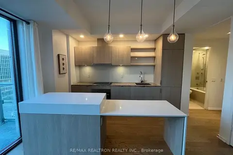
$2,300/mo
1 bd1 ba500-599 ft²
12 Bonnycastle Street 911
Waterfront Communities C8, Toronto
Condo Apartment · MLS® C13857626 · RE/MAX REALTRON REALTY INC.
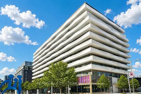
$2,300/mo
1+1 bd1 ba600-699 ft²
60 Tannery Road 614
Waterfront Communities C8, Toronto
Condo Apartment · MLS® C13867836 · RE/MAX PLUS CITY TEAM INC.
$2,300/mo
1 bd1 ba600-699 ft²
25 The Esplanade 411
Waterfront Communities C8, Toronto
Condo Apartment · MLS® C13875486 · UNION REALTY BROKERAGE INC.
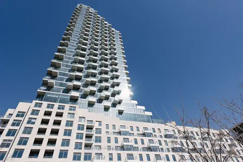
$2,300/mo
1 bd1 ba500-599 ft²
12 Bonnycastle Street 525
Waterfront Communities C8, Toronto
Condo Apartment · MLS® C13886796 · HOMELIFE NEW WORLD REALTY INC.
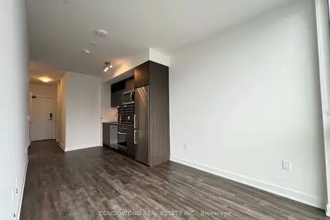
$2,300/mo
1+1 bd1 ba500-599 ft²
135 Lower Sherbourne Street 1954
Waterfront Communities C8, Toronto
Condo Apartment · MLS® C14029212 · CONDOWONG REAL ESTATE INC.
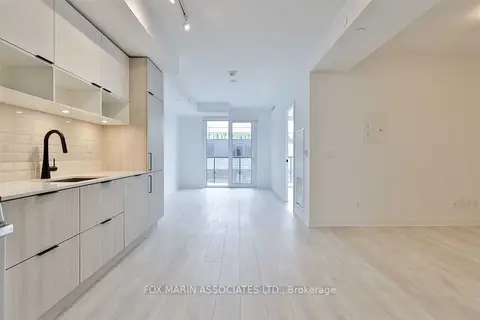
$2,300/mo
1+1 bd1 ba500-599 ft²
180 Mill Street S517
Waterfront Communities C8, Toronto
Condo Apartment · MLS® C14079926 · FOX MARIN ASSOCIATES LTD.
 New
$2,300/mo
1 bd1 ba500-599 ft²
28 Freeland Street 1303
Waterfront Communities C8, Toronto
Condo Apartment · MLS® C14090322 · ROYAL LEPAGE REAL ESTATE SERVICES LTD.
 New
$2,300/mo
1+1 bd1 ba500-599 ft²
15 RICHARDSON Street 418
Waterfront Communities C8, Toronto
Condo Apartment · MLS® C14095556 · RE/MAX REALTY SPECIALISTS INC.