4065 Confederation Parkway P2
City Centre, Mississauga, L5B 0L4 · More in this building
$180/mo
- 0 bedrooms
- 0 bathrooms
- 1 parking
- 500-599 sq ft
Listed 3 days ago · MLS® W14089764
About this home
AVAILABLE IMMEDIATELY!! Parking Space Located At 4065 CONFEDERATION PKY. P2-ACROSS TO THE ENTANCE, Underground Parking.Monthly Lease Payment.Must Be A Registered Resident Of The 4065 CONFEDERATION PKY Building To Lease. Also, Locker Available for Lease $80/month.
Details
- Type
- Condo Apartment
- Style
- Apartment
- Size
- 500-599 sq ft
- Basement
- None
- Garage
- Underground
- Kitchens
- 0
- Neighbourhood
- City Centre
- Municipality
- Mississauga
- Rent increase limit
- Depends on when the unit was first lived in: before Nov. 15, 2018 it’s covered by Ontario’s yearly limit (2.1% in 2026); after, there’s no cap.
Interior
- Bedrooms
- 0 above ground
- Family room or den
- No
- Fireplace
- No
- Furnished
- Unfurnished
Building and exterior
- Style
- Apartment
- Exterior
- Concrete
Parking
- Garage spaces
- 1
- Total parking
- 1
Condo
- Exposure
- South
- Property manager
- DUKA Property Management Inc.
Rental terms
- Rent includes
- Parking
More
- Possession
- Immed/Flex
- Cross street
- Burnhamthorpe & Confederation
History of this address
1 earlier listing at this address, with sold and leased prices. Create a free account or sign in to see them.
Location
Location is approximate. See nearby homes on the map
The neighbourhood
Getting around Very walkable
- 🚆 Cooksville GO1.8 km
Within a 10-minute walk: 5 grocery stores, 60 cafés and restaurants, 7 parks, 12 pharmacies. Nearest grocery: Rabba (150 m). Nearest park: Community Common (200 m).
Schools nearby
Elementary
- Corpus Christi School Catholic
EQAO: Gr 6 reading 95%, math 63%8 min walk - Fairview Public School
EQAO: Gr 3 reading 73%, math 73%12 min walk - Bishop Scalabrini School Catholic
EQAO: Gr 6 reading 74%, math 43%13 min walk - St. Philip Elementary School Catholic
EQAO: Gr 6 reading 84%, math 54%1.4 km
Secondary
- Father Michael Goetz Secondary School Catholic
EQAO: Gr 9 math 44%, literacy test 80%16 min walk - Elm Drive Public School17 min walk
EQAO: share of students meeting the provincial standard (2024–25). Ontario average: Gr 6 reading 86%, math 51%; Gr 9 math 55%; literacy test 83%.
Closest schools, not school zones. Check which school serves this address with the school board before relying on it.
Who lives here postal area L5B
- Owners / renters
- 55% / 45%
- Median household income
- $79,000
- Average age
- 40
- Children under 15
- 15%
- Homes
- 14% detached, 71% high-rise
- Commute by transit
- 15%
- Population
- 67,131
Languages spoken most at home besides English: Arabic 5.2%, Mandarin 3.3%, Urdu 3%, Polish 2.2%.
Flood and conservation No mapped hazard
Not inside a mapped flood plain or regulated area.
Screening maps only. Ask the conservation authority for a property inquiry before relying on this.
Safety
Crime Severity Index for Peel Region (Mississauga/Brampton) police: 59 vs 57 for Ontario (2025).
Police-reported figures for the whole police service area, not this street. Rates use the area’s resident population.
Development nearby 4 active
-
355 Burnhamthorpe Rd W · 100 mDevelopment application · In process · applied 20253 residential buildings (1874 homes)
-
4015 Parkside Village Drive · 200 mDevelopment application · In process · applied 2025Two residential towers (55 and 45 storeys) with ground floor retail (1232 homes)
-
335 Burnhamthorpe Road West (previously 325 Burnhamthopre Rd W) · 150 mDevelopment application · In process · applied 2022Site plan for two towers built on a shared podium - phase 1 (1110 homes)
-
4250 LIVING ARTS DRIVE AND 320 RATHBURN ROAD WEST (PREVIOUSLY 4220 LIVING ARTS DRIVE) · 500 mDevelopment application · In process · applied 2019Two residential / mixed use towers - 41 and 31 storeys w pops/mews (747 homes)
Rezoning, site plan, subdivision and condominium applications filed with the city.
Distances are approximate. Places © OpenStreetMap contributors. Neighbourhood figures: Statistics Canada, 2021 Census. School results: EQAO via Ontario Data Catalogue (Open Government Licence – Ontario). Crime Severity Index: Statistics Canada. Planning applications: City of Mississauga open data.
Living here
Commute
To Union Station (downtown Toronto): 22 km. Transit times · Driving times
Coming transit
- 🚧 Burnhamthorpe Hazel McCallion LRT1.2 km · opening about 2029
- 🚧 Robert Speck Hazel McCallion LRT1.2 km · opening about 2029
- 🚧 Fairview Hazel McCallion LRT1.4 km · opening about 2029
Stations under construction or approved. Opening dates are the latest public estimates and often move.
Noise Nothing major nearby
No highway within 500 m, rail line within 300 m, or airport flight path nearby.
Distances from the map, not noise measurements. Visit at rush hour to judge for yourself.
Internet High-speed
50/10 Mbps or faster available here by cable, fibre or DSL (the federal high-speed target).
From the federal broadband map. Check exact speeds and providers for the address.
Short-term rentals
Only in your principal residence, with a City licence: not allowed in investment properties. Up to 180 nights a year, no more than 30 in a row.
Roads, rail, airports and planned stations © OpenStreetMap contributors. Internet: Innovation, Science and Economic Development Canada, National Broadband Data.
Listed by EXP REALTY.
Listing information provided by PropTx Innovations Inc. and TRREB; deemed reliable but not guaranteed accurate by PropTx.
Similar homes nearby
See more in Mississauga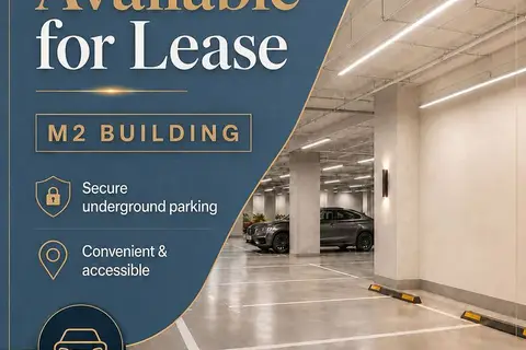
$150/mo
0 bd0 ba1 pk
3883 Quartz Road P3-10
City Centre, Mississauga
Parking Space · MLS® W13623120 · PROPERTY.CA INC.
$150/mo
0 bd0 ba1 pk0-499 ft²
3115 Boxford Crescent Parking
Churchill Meadows, Mississauga
Condo Townhouse · MLS® W12933364 · SUTTON GROUP - SUMMIT REALTY INC.