3513 Dundas Street W
Runnymede-Bloor West Village, Toronto, M6S 2S6
$4,250,000
- 2 bathrooms
Listed 83 days ago · MLS® W13618104
About this home
An incredible opportunity to acquire this highly visible corner property in Toronto's West Junction neighbourhood. With over 12000 sq ft (.283acres) and over 100 ft of frontage, this well-positioned property is ideally suited for a wide variety of uses. Surrounded by several new development projects, including low-rise purpose-built residential, self-storage, retail and medical, this property represents a great addition to any portfolio or is ideal for an end user. The current property is tenanted with decent holding income.
Details
- Type
- Commercial Retail
- Lot
- 105.67 × 137 ft
- Garage
- Outside/Surface
- Property tax
- $27,859 (2025)
- Neighbourhood
- Runnymede-Bloor West Village
- Municipality
- Toronto W02
Interior
- Bathrooms
- 2 × bathroom
Heating, cooling and services
- Heating
- Gas Forced Air Open
- Air conditioning
- Yes
- Water and sewer
- Sanitary
- Utilities
- Yes
Building and exterior
- Building area
- 12,314 Square Feet
More
- Possession
- TBD
- Cross street
- Dundas St W & Jane St
History of this address
2 earlier listings at this address, with sold and leased prices. Create a free account or sign in to see them.
Location
Location is approximate. See nearby homes on the map
Recent sales nearby
See what similar homes within 1 km sold for in the last year. Create a free account or sign in to see them.
The neighbourhood
Getting around Very walkable
- 🚇 Jane Subway1.8 km
- 🚇 Old Mill Subway1.8 km
- 🚆 Mount Dennis GO2.5 km
Within a 10-minute walk: 7 grocery stores, 36 cafés and restaurants, 7 parks, 3 pharmacies. Nearest grocery: FreshCo (400 m). Nearest park: Woolner Park (700 m).
Schools nearby
Elementary
- King George Junior Public School
EQAO: Gr 6 reading 95%, math 79%5 min walk - George Syme Community School
EQAO: Gr 6 reading 73%, math 35%6 min walk - St. James Catholic School Catholic
EQAO: Gr 6 reading 100%, math 64%8 min walk - Humbercrest Public School
EQAO: Gr 6 reading 100%, math 64%9 min walk
Secondary
- Runnymede Collegiate Institute
EQAO: Gr 9 math 15%, literacy test 76%3 min walk - Rockcliffe Middle School15 min walk
- Frank Oke Secondary School1.4 km
EQAO: share of students meeting the provincial standard (2024–25). Ontario average: Gr 6 reading 86%, math 51%; Gr 9 math 55%; literacy test 83%.
Closest schools, not school zones. Check which school serves this address with the school board before relying on it.
Who lives here postal area M6S
- Owners / renters
- 68% / 32%
- Median household income
- $108,000
- Average age
- 41
- Children under 15
- 17%
- Homes
- 36% detached, 29% high-rise
- Commute by transit
- 24%
- Population
- 34,029
Languages spoken most at home besides English: Ukrainian 1%, Russian 1%, Spanish 1%, Polish 1%.
Flood and conservation No mapped hazard
Not inside a mapped flood plain or regulated area.
Screening maps only. Ask the conservation authority for a property inquiry before relying on this.
Safety
Major crime per resident in Runnymede-Bloor West Village (2025): about the Toronto average, up 9% from the year before.
- Assault28% below average
- Break and enter43% below average
- Auto theft36% above average
- Robberyabout average
- Theft from vehiclesabout average
- Shootingsnone reported
Crime Severity Index for Toronto police: 60 vs 57 for Ontario (2025).
Police-reported figures for the whole neighbourhood, not this street. Rates use the area’s resident population.
Development nearby 4 active
-
12 BATAVIA AVE · 350 mPlan of Condominium · Under Review · applied 2026Draft Plan of Condominium Application - 5 Units.Application details
-
3434 DUNDAS ST W · 250 mSite Plan · Under Review · applied 2026Site Plan Approval for a new 5-storey Post Traumatic Stress Injury Centre of Excellence for Runnymede Healthcare Centres.Application details
-
3459 DUNDAS ST W · 150 mSite Plan · Under Review · applied 2025Proposed 7-storey mixed-use building. The proposed development includes 34 dwelling units, ranging in size from bachelor to 3-bedroom units. One live-work unit…Application details
-
686 JANE ST · 450 mSite Plan · Under Review · applied 2019INACTIVE To legalize an existing 1-storey brick structure into Place of Worship. The existing building was originally a Veterans Hall but later converted into…Application details
-
2595 ST CLAIR AVE W · 200 mOfficial Plan / Zoning By-law Amendment · Closed · applied 2025Proposal for the removal of the Holding (H) provision.Application details
-
3461 DUNDAS ST W · 150 mOfficial Plan / Zoning By-law Amendment · Closed · applied 2025Proposed 7-storey mixed-use building. The proposed development includes 45 dwelling units, ranging in size from bachelor to 3-bedroom units. 65 square metres…Application details
1 more within 500 m.
Rezoning, site plan, subdivision and condominium applications filed with the city.
Distances are approximate. Places © OpenStreetMap contributors. Neighbourhood figures: Statistics Canada, 2021 Census. School results: EQAO via Ontario Data Catalogue (Open Government Licence – Ontario). Neighbourhood crime: Toronto Police Service Public Safety Data Portal (Open Government Licence – Toronto Police Service). Crime Severity Index: Statistics Canada. Planning applications: City of Toronto open data.
Living here
Commute
To Union Station (downtown Toronto): 9 km. Transit times · Driving times
Noise 1 source nearby
- 🚆 Rail line (Galt Subdivision)100 m
Distances from the map, not noise measurements. Visit at rush hour to judge for yourself.
Trees
35 City street trees within 100 m, mostly maples. That’s about the Toronto average of 42.
Trees on City boulevards only, not private yards or parks.
Internet High-speed
50/10 Mbps or faster available here by cable, fibre or DSL (the federal high-speed target).
From the federal broadband map. Check exact speeds and providers for the address.
Zoning, heritage, building permits and street trees: City of Toronto open data (Open Government Licence – Toronto). Roads, rail, airports and planned stations © OpenStreetMap contributors. Internet: Innovation, Science and Economic Development Canada, National Broadband Data.
Listed by ROYAL LEPAGE REAL ESTATE SERVICES LTD..
Listing information provided by PropTx Innovations Inc. and TRREB; deemed reliable but not guaranteed accurate by PropTx.
Similar homes nearby
See more in Toronto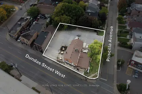
$4,250,000
2 ba
3513 Dundas Street W
Runnymede-Bloor West Village, Toronto
Land · MLS® W13618120 · ROYAL LEPAGE REAL ESTATE SERVICES LTD.
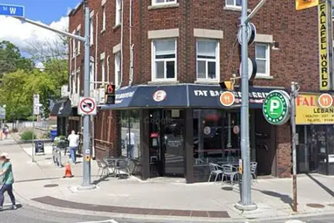
$3,999,000
2400 Bloor Street W
Runnymede-Bloor West Village, Toronto
Commercial Retail · MLS® W13605076 · HOMELIFE LANDMARK REALTY INC.
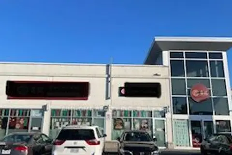
$4,280,000
3250 Midland Avenue
Milliken, Toronto
Commercial Retail · MLS® E13624122 · AIMHOME REALTY INC.
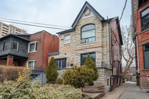
$4,295,000
70 Melbourne Avenue
South Parkdale, Toronto
Investment · MLS® W13795488 · ROYAL LEPAGE MEADOWTOWNE REALTY
$4,200,000
4 ba
1052 Bathurst Street
Annex, Toronto
Store W Apt/Office · MLS® C13464044 · RE/MAX REALTY SPECIALISTS INC.
$4,200,000
1066 Yonge Street
Rosedale-Moore Park, Toronto
Commercial Retail · MLS® C13742560 · SUTTON GROUP-ADMIRAL REALTY INC.
$4,300,000
499 Queen Street W
Waterfront Communities C1, Toronto
Commercial Retail · MLS® C13825804 · COLLIERS
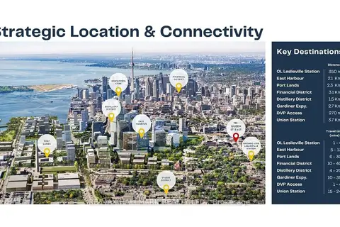
$4,300,000
Reduced $1,650,000
701 Queen Street E
South Riverdale, Toronto
Store W Apt/Office · MLS® E11911391 · RE/MAX HALLMARK REALTY LTD.