2985 NE Drew Road 202
Northeast, Mississauga, L4T 0A4
$749,000
Reduced $150,000 from $899,000
Listed 260 days ago · MLS® W12747810
About this home
Excellent Opportunity in the heart of Mississauga to Run Your Own professional office space. In a Prime Location At Prestige Plaza In The Mississauga Area, Offering Ample outdoor & covered Parking Space. Professionally Finished Unit Featuring with Five Offices & large windows, a Kitchen, private washroom and a Spacious Reception/Lounge Area. Close To Pearson International Airport And Major Highways (407/401/427Access. Suitable For Various Professional Uses Such As Accounting, Legal Services, Immigration Consultation, And More. Maintenance Fee: $673.53/Month - Includes Water, Building Insurance, And Common Area Maintenance.
Details
- Type
- Office
- Age
- 16-30 years
- Garage
- Outside/Surface
- Property tax
- $5,852 (2025)
- Neighbourhood
- Northeast
- Municipality
- Mississauga
Heating, cooling and services
- Heating
- Gas Forced Air Open
- Air conditioning
- Yes
- Water and sewer
- Sanitary+Storm
- Utilities
- Yes
Building and exterior
- Age
- 16-30 years
- Building area
- 1,220 Square Feet
More
- Possession
- VACANT- IMMEDIATE
- Cross street
- AIRPORT RD/DERRY
Location
Location is approximate. See nearby homes on the map
Recent sales nearby
See what similar homes within 1 km sold for in the last year. Create a free account or sign in to see them.
The neighbourhood
Getting around Somewhat walkable
- 🚆 Bramalea GO Station3.3 km
Within a 10-minute walk: no grocery stores, 4 cafés and restaurants, 4 parks, 1 pharmacy. Nearest park: Malton Village Park (500 m).
Schools nearby
Elementary
- Marvin Heights Public School
EQAO: Gr 3 reading 86%, math 81%9 min walk - Lancaster Public School
EQAO: Gr 3 reading 62%, math 44%15 min walk - Ridgewood Public School
EQAO: Gr 3 reading 71%, math 58%18 min walk - St. Raphael School Catholic
EQAO: Gr 6 reading 83%, math 31%1.3 km
Secondary
- Morning Star Middle School9 min walk
- Ascension of Our Lord Secondary School Catholic
EQAO: Gr 9 math 40%, literacy test 69%1.3 km - Lincoln M. Alexander Secondary School
EQAO: Gr 9 math 37%, literacy test 80%1.8 km
EQAO: share of students meeting the provincial standard (2024–25). Ontario average: Gr 6 reading 86%, math 51%; Gr 9 math 55%; literacy test 83%.
Closest schools, not school zones. Check which school serves this address with the school board before relying on it.
Who lives here postal area L4T
- Owners / renters
- 60% / 40%
- Median household income
- $84,000
- Average age
- 38
- Children under 15
- 16%
- Homes
- 22% detached, 11% high-rise
- Commute by transit
- 21%
- Population
- 38,182
Languages spoken most at home besides English: Punjabi (Panjabi) 18.6%, Urdu 3%, Hindi 2.5%, Gujarati 2.4%.
Flood and conservation Flood plain
This address falls inside a mapped flood plain (Toronto and Region Conservation Authority). Building, additions and grading need a permit from the conservation authority, and flood insurance can cost more or be harder to get.
Screening maps only. Ask the conservation authority for a property inquiry before relying on this.
Safety
Crime Severity Index for Peel Region (Mississauga/Brampton) police: 59 vs 57 for Ontario (2025).
Police-reported figures for the whole police service area, not this street. Rates use the area’s resident population.
Development nearby
No planning applications within 500 m in the last five years.
Rezoning, site plan, subdivision and condominium applications filed with the city.
Distances are approximate. Places © OpenStreetMap contributors. Neighbourhood figures: Statistics Canada, 2021 Census. School results: EQAO via Ontario Data Catalogue (Open Government Licence – Ontario). Flood and regulation mapping: Toronto and Region Conservation Authority open data. Crime Severity Index: Statistics Canada. Planning applications: City of Mississauga open data.
Living here
Commute
To Union Station (downtown Toronto): 23 km. Transit times · Driving times
Noise Nothing major nearby
No highway within 500 m, rail line within 300 m, or airport flight path nearby.
Distances from the map, not noise measurements. Visit at rush hour to judge for yourself.
Internet High-speed
50/10 Mbps or faster available here by cable, fibre or DSL (the federal high-speed target).
From the federal broadband map. Check exact speeds and providers for the address.
Roads, rail, airports and planned stations © OpenStreetMap contributors. Internet: Innovation, Science and Economic Development Canada, National Broadband Data.
Listed by REMAX YOUR COMMUNITY REALTY.
Listing information provided by PropTx Innovations Inc. and TRREB; deemed reliable but not guaranteed accurate by PropTx.
Similar homes nearby
See more in Mississauga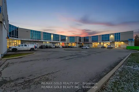
$750,000
1 ba
2985 Drew Road 110
Northeast, Mississauga
Commercial Retail · MLS® W13820324 · RE/MAX GOLD REALTY INC.
$745,000
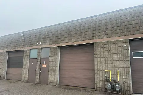
1080 Tristar Drive 6
Northeast, Mississauga
Industrial · MLS® W13816212 · AVISON YOUNG COMMERCIAL REAL ESTATE SERVICES, LP

$795,000
5150 Dixie Road 1B
Northeast, Mississauga
Sale Of Business · MLS® W13496826 · ROYAL LEPAGE REAL ESTATE SERVICES LTD.

$699,000
2 ba
5500 Tomken Road 7
Northeast, Mississauga
Sale Of Business · MLS® W13627168 · RIGHT AT HOME REALTY
$719,900
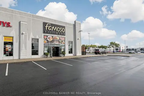
6045 Mavis Road 7
East Credit, Mississauga
Sale Of Business · MLS® W13711900 · COLDWELL BANKER IKC REALTY

$799,000
Address withheld · Sheridan
Sheridan, Mississauga
Sale Of Business · MLS® W13673350 · HOMELIFE/MIRACLE REALTY LTD
$687,000
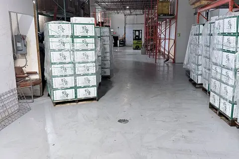
330 Brunel Road
Gateway, Mississauga
Sale Of Business · MLS® W13831094 · CENTRAL HOME REALTY INC.
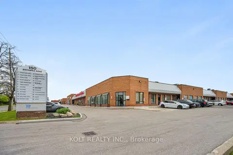
$819,900
190 Britannia Road E 9
Gateway, Mississauga
Industrial · MLS® W12937412 · KOLT REALTY INC.