295 Alliance Road 6
1034 - MN Milton North, Milton, L9T 4W8
$3,480/mo
Listed 5 days ago · MLS® W14081522
About this home
WELL APPOINTED INDUSTRIAL UNIT AVAILABLE FOR SUBLEASE. SUBLEASE TERM ENDS IN SEPTEMBER 2027.LONGER TERM AVAILABLE. PROFESSIONALLY MANAGED SPACE IN CLOSE PROXIMITY TO ALL LOCAL AMENITIESAND WITHIN MOMENTS OF THE 401.
Details
- Type
- Industrial
- Lot
- 154 × 402 ft
- Garage
- Outside/Surface
- Neighbourhood
- 1034 - MN Milton North
- Municipality
- Milton
Heating, cooling and services
- Heating
- Gas Forced Air Open
- Air conditioning
- Partial
- Water and sewer
- Sanitary+Storm
- Utilities
- Yes
Building and exterior
- Building area
- 1,600 Square Feet
Rental terms
- Minimum term
- 36 months
More
- Possession
- Flexible
- Cross street
- WHEELABRATOR/STEELES
- Business type
- Warehouse
Location
Location is approximate. See nearby homes on the map
The neighbourhood
Getting around Somewhat walkable
- 🚆 Milton GO2.1 km
Within a 10-minute walk: no grocery stores, 11 cafés and restaurants, 3 parks, 1 pharmacy. Nearest park: Kingsleigh Court Park (450 m).
Schools nearby
Elementary
- Holy Rosary Catholic Elementary School Catholic
EQAO: Gr 6 reading 88%, math 40%16 min walk - Martin Street Public School
EQAO: Gr 6 reading 91%, math 44%17 min walk - Tarbiyah Elementary School Private19 min walk
- Robert Baldwin Public School
EQAO: Gr 3 reading 79%, math 75%1.2 km
Secondary
- W. I. Dick Middle School9 min walk
EQAO: share of students meeting the provincial standard (2024–25). Ontario average: Gr 6 reading 86%, math 51%; Gr 9 math 55%; literacy test 83%.
Closest schools, not school zones. Check which school serves this address with the school board before relying on it.
Who lives here postal area L9T
- Owners / renters
- 83% / 17%
- Median household income
- $126,000
- Average age
- 35
- Children under 15
- 24%
- Homes
- 53% detached, 6% high-rise
- Commute by transit
- 4%
- Population
- 110,956
Languages spoken most at home besides English: Urdu 6.1%, Arabic 2.2%, Spanish 1.5%, Punjabi (Panjabi) 1.1%.
Flood and conservation No mapped hazard
Not inside a mapped flood plain or regulated area in Credit Valley Conservation’s mapping.
Screening maps only. Ask the conservation authority for a property inquiry before relying on this.
Safety
Crime Severity Index for Halton Region (Oakville/Burlington) police: 31 vs 57 for Ontario (2025).
Police-reported figures for the whole police service area, not this street. Rates use the area’s resident population.
Distances are approximate. Places © OpenStreetMap contributors. Neighbourhood figures: Statistics Canada, 2021 Census. School results: EQAO via Ontario Data Catalogue (Open Government Licence – Ontario). Flood and regulation mapping: Credit Valley Conservation open data. Crime Severity Index: Statistics Canada.
Living here
Commute
To Union Station (downtown Toronto): 43 km. Transit times · Driving times
Noise 1 source nearby
- 🚆 Rail line (Halton Subdivision)150 m
Distances from the map, not noise measurements. Visit at rush hour to judge for yourself.
Internet High-speed
50/10 Mbps or faster available here by cable, fibre or DSL (the federal high-speed target).
From the federal broadband map. Check exact speeds and providers for the address.
Roads, rail, airports and planned stations © OpenStreetMap contributors. Internet: Innovation, Science and Economic Development Canada, National Broadband Data.
Listed by ROYAL LEPAGE MEADOWTOWNE REALTY.
Listing information provided by PropTx Innovations Inc. and TRREB; deemed reliable but not guaranteed accurate by PropTx.
Similar homes nearby
See more in Milton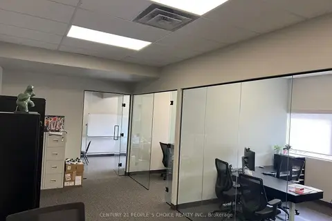
$3,600/mo
420 Main Street E 205
1035 - OM Old Milton, Milton
Office · MLS® W13654080 · CENTURY 21 PEOPLE`S CHOICE REALTY INC.
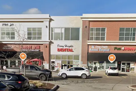
$3,700/mo
6901 Derry Road W 207
1035 - OM Old Milton, Milton
Office · MLS® W13781534 · RE/MAX REAL ESTATE CENTRE INC.
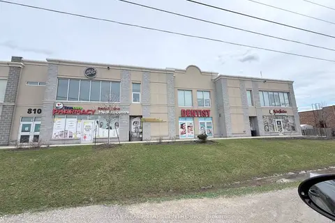
$3,850/mo
810 NIPISSING Road 208-210
1037 - TM Timberlea, Milton
Office · MLS® W12973786 · RE/MAX REAL ESTATE CENTRE INC.
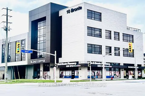
$3,000/mo
10 Bronte Street S 403
1035 - OM Old Milton, Milton
Office · MLS® W12443434 · PROPERTY.CA INC.
$3,000/mo
9129 Derry Road 35
1027 - CL Clarke, Milton
Commercial Retail · MLS® W13486160 · RE/MAX REAL ESTATE CENTRE INC.
$4,000/mo
57 Steeles Avenue E
1035 - OM Old Milton, Milton
Commercial Retail · MLS® W13767932 · RE/MAX ESCARPMENT REALTY INC.