26 Taylor Boulevard
Port Perry, Scugog, L9L 1B2
$13/mo
- 1 bathrooms
Listed 20 days ago · MLS® E13840656
About this home
Unique Industrial Leasing Opportunity - North Port Industrial Park, Port Perry. An exceptional industrial leasing opportunity located in Port Perry's North Port Industrial Park, offering convenient access to Highway 12/7, Highway 407, Highway 401 and Highway 404, all within approximately 35 minutes The property features 234.94 feet of frontage on 2.46 acres of land, as per MPAC, and is improved with a 12,300-square-footindustrial building. The site includes secure perimeter fencing, gravel parking and storage yard, and level topography. The building offers a maximum 12-foot warehouse ceiling height and is currently vacant. Zoned M-2 Industrial, the property permits a variety of industrial uses, including outdoor storage. The clear-span building provides flexibility for a single-user operation or can be configured and divided to accommodate multiple tenants. The property is equipped with 600-volt electrical service, 120/208-volt three-phase power, a heated floor in the main office area, and high-speed internet. There is also potential for future expansion. The property is designated Core Employment under the Official Plan and is zoned for industrial use, providing a strong foundation for a range of industrial, manufacturing, warehousing and related commercial applications.Highlights:12,300 SF industrial building built 2002 2.46 acres 234.94' frontage M-2 zoning 12' warehouse ceiling height Clear-span construction Secure fenced yard Outdoor storage permitted Gravel parking/storage area 600V electrical service 120/208V 3-phase power Expansion potential Core Employment designation
Details
- Type
- Industrial
- Lot
- 234.94 × 545.97 ft
- Garage
- None
- Property tax
- $33,804 (2025)
- Neighbourhood
- Port Perry
- Municipality
- Scugog
Interior
- Bathrooms
- 1 × bathroom
Heating, cooling and services
- Heating
- Gas Forced Air Closed
- Water and sewer
- Septic
- Utilities
- Available
Building and exterior
- Building area
- 12,300 Sq Ft Divisible
Rental terms
- Minimum term
- 60 months
More
- Possession
- TBA
- Cross street
- North Port Road/Reach St.
- Business type
- Factory/Manufacturing
Location
Location is approximate. See nearby homes on the map
The neighbourhood
Getting around Somewhat walkable
No subway, LRT or GO station within a short trip.
Within a 10-minute walk: 2 grocery stores, 1 cafés and restaurants, 0 parks. Nearest grocery: Walmart Supercenter (750 m).
Schools nearby
Elementary
- Good Shepherd Catholic School Catholic
EQAO: Gr 6 reading 76%, math 19%1.5 km - R. H. Cornish Public School
EQAO: Gr 6 reading 89%, math 63%1.5 km - S. A. Cawker Public School1.9 km
Secondary
- Port Perry High School
EQAO: Gr 9 math 57%, literacy test 84%1.6 km
EQAO: share of students meeting the provincial standard (2024–25). Ontario average: Gr 6 reading 86%, math 51%; Gr 9 math 55%; literacy test 83%.
Closest schools, not school zones. Check which school serves this address with the school board before relying on it.
Who lives here postal area L9L
- Owners / renters
- 84% / 16%
- Median household income
- $107,000
- Average age
- 47
- Children under 15
- 14%
- Homes
- 85% detached, 1% high-rise
- Commute by transit
- 1%
- Population
- 14,620
Languages spoken most at home besides English: Mandarin 0.2%, Yue (Cantonese) 0.1%, Tamil 0.1%, Russian 0.1%.
Flood and conservation No mapped hazard
Not inside a mapped flood plain or regulated area.
Screening maps only. Ask the conservation authority for a property inquiry before relying on this.
Safety
Crime Severity Index for Durham Region (Oshawa/Whitby/Ajax) police: 43 vs 57 for Ontario (2025).
Police-reported figures for the whole police service area, not this street. Rates use the area’s resident population.
Distances are approximate. Places © OpenStreetMap contributors. Neighbourhood figures: Statistics Canada, 2021 Census. School results: EQAO via Ontario Data Catalogue (Open Government Licence – Ontario). Crime Severity Index: Statistics Canada.
Living here
Commute
To Union Station (downtown Toronto): 60 km. Transit times · Driving times
Noise Nothing major nearby
No highway within 500 m, rail line within 300 m, or airport flight path nearby.
Distances from the map, not noise measurements. Visit at rush hour to judge for yourself.
Internet High-speed
50/10 Mbps or faster available here by cable, fibre or DSL (the federal high-speed target).
From the federal broadband map. Check exact speeds and providers for the address.
Roads, rail, airports and planned stations © OpenStreetMap contributors. Internet: Innovation, Science and Economic Development Canada, National Broadband Data.
Listed by MinCom Kawartha Lakes Realty Inc..
Listing information provided by PropTx Innovations Inc. and TRREB; deemed reliable but not guaranteed accurate by PropTx.
Similar homes nearby
See more in Scugog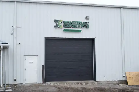
$16/mo
Reduced $4,184
2 ba
3490 Highway 7A 2
Rural Scugog, Scugog
Industrial · MLS® E13012730 · COLDWELL BANKER - R.M.R. REAL ESTATE