197 Adelaide Street S Unit B
South L, London South, N5Z 3K7
$8/mo
- 2 bathrooms
Listed 130 days ago · MLS® X13437336
About this home
10,400 square feet of warehouse/retail space with excellent street frontage and signage opportunity along busy Adelaide Street South. May be demised into 2 - 5,000 sq ft units for qualified tenants. Average daily vehicle traffic volume of 22,000 vehicles per day. Open concept floor plan with open ceilings, spiral ducts and black sprayed finish. 10 foot clear height. Double man doors accessed from the rear with potential for additional dock and/or grade loading access. Zoned LI1. Permits a wide range of uses including warehousing, office support, wholesale establishments and more. 600V/200A power. Ample on-site parking. Excellent exposure. Pylon signage available. Conveniently located in well known area featuring retail/wholesale sales of building supplies, tools and hardware, furniture and décor, recreational products etc. Excellent location with quick access to Hwy 401. Introductory first year lease rate of $8.00 per sq ft for qualified tenants on a minimum 5 year lease term.
Details
- Type
- Industrial
- Lot
- 150 × ? ft
- Garage
- Outside/Surface
- Property tax
- $5 (2025)
- Neighbourhood
- South L
- Municipality
- London South
Interior
- Bathrooms
- 2 × bathroom
Heating, cooling and services
- Heating
- Gas Forced Air Open
- Air conditioning
- Yes
- Utilities
- Available
Building and exterior
- Building area
- 10,400 Sq Ft Divisible
Rental terms
- Minimum term
- 36 months
More
- Possession
- Flexible
- Cross street
- Thompson Road
- Business type
- Warehouse
Location
Location is approximate. See nearby homes on the map
The neighbourhood
Getting around Somewhat walkable
No subway, LRT or GO station within a short trip.
Within a 10-minute walk: no grocery stores, 5 cafés and restaurants, 6 parks, 1 pharmacy. Nearest park: Glen Cairn Park West (400 m).
Schools nearby
Elementary
- Princess Elizabeth Public School
EQAO: Gr 6 reading 88%, math 53%4 min walk - Holy Rosary Separate School Catholic
EQAO: Gr 6 reading 80%, math 24%12 min walk - C.C. Carrothers Public School
EQAO: Gr 6 reading 50%, math 27%16 min walk - St. Sebastian Catholic School Catholic
EQAO: Gr 6 reading 85%, math 45%1.3 km
Secondary
- Wheable Adult Education Centre10 min walk
- B. Davison Secondary School1.3 km
- Lester B. Pearson School for the Arts1.4 km
EQAO: share of students meeting the provincial standard (2024–25). Ontario average: Gr 6 reading 86%, math 51%; Gr 9 math 55%; literacy test 83%.
Closest schools, not school zones. Check which school serves this address with the school board before relying on it.
Who lives here postal area N5Z
- Owners / renters
- 62% / 38%
- Median household income
- $64,500
- Average age
- 41
- Children under 15
- 16%
- Homes
- 50% detached, 8% high-rise
- Commute by transit
- 6%
- Population
- 24,067
Languages spoken most at home besides English: Spanish 1.7%, Arabic 1.5%, Portuguese 1.1%, Polish 1%.
Safety
Crime Severity Index for London police: 73 vs 57 for Ontario (2025).
Police-reported figures for the whole police service area, not this street. Rates use the area’s resident population.
Distances are approximate. Places © OpenStreetMap contributors. Neighbourhood figures: Statistics Canada, 2021 Census. School results: EQAO via Ontario Data Catalogue (Open Government Licence – Ontario). Crime Severity Index: Statistics Canada.
Living here
Commute
To downtown London: 3 km. Transit times · Driving times
Noise 1 source nearby
- 🚆 Rail line (Talbot Spur)100 m
Distances from the map, not noise measurements. Visit at rush hour to judge for yourself.
Internet High-speed
50/10 Mbps or faster available here by cable, fibre or DSL (the federal high-speed target).
From the federal broadband map. Check exact speeds and providers for the address.
Roads, rail, airports and planned stations © OpenStreetMap contributors. Internet: Innovation, Science and Economic Development Canada, National Broadband Data.
Listed by THRIVE REALTY GROUP INC..
Listing information provided by PropTx Innovations Inc. and TRREB; deemed reliable but not guaranteed accurate by PropTx.
Similar homes nearby
See more in London South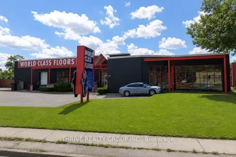
$6/mo
2 ba
197 Adelaide Street S Unit B2
South L, London South
Industrial · MLS® X13437338 · THRIVE REALTY GROUP INC.

$8/mo
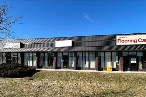
3330 White Oak Road Building B
South W, London South
Industrial · MLS® X13443802 · Sutton Group - First Choice Realty Ltd.
$10/mo
412 NEWBOLD Street 2
South Z, London South
Industrial · MLS® X12889264 · ROYAL LEPAGE TRILAND REALTY
 New
$10/mo
2 ba
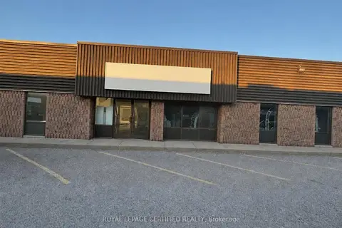
610 Newbold Street 6
South Z, London South
Industrial · MLS® X14099170 · ROYAL LEPAGE CERTIFIED REALTY