17 Private Drive
Rural Bradford West Gwillimbury, Bradford West Gwillimbury, L3Z 3H3
$248,000
- 0 bedrooms
- 0 bathrooms
- 7 parking
- < 700 sq ft
Listed 147 days ago · MLS® N13173370
About this home
Rare Waterfront Opportunity On The Holland River! This 50 X 100 Ft Property Is Accessed Via A Private Road With Direct Access To Yonge St Offering A Prime Waterfront Setting With A Short Boat Ride To Lake Simcoe And Access To The Trent-Severn Waterway-Perfect For Boating, Fishing, And Year-Round Outdoor Activities. Conveniently Located Just 1 Minute To Gas Station, 2 Minutes To Bradford GO, 5 Minutes To Newmarket, And 35 Minutes To Toronto, With Easy Access To Major Highways. The Property Features A Fixer-Upper With Active Hydro Service And Unbeatable Low Taxes For Affordable Waterfront Ownership. There Is Potential To Install A Dock, And A Pile Driver Is Included To Make Rebuilding Easy. Covered Parking For Two Plus Additional Parking For Five Vehicles Ensures Ample Space, While Two 20-Ft Sea Cans Provide 320 Sq Ft Of Storage. An I-Beam Is Also In Place, Perfect For Lifting Boats And Motors. Bring Your Vision And Seize This Incredible Opportunity To Own Waterfront Property! 60 Amps Hydro Service. Dwelling Built 1912. Roof 2012. Piles/Pillars Replaced With Permit 2004.
Details
- Type
- Detached
- Style
- Bungalow
- Size
- < 700 sq ft
- Lot
- 50 × 100 ft
- Basement
- None
- Garage
- Carport
- Kitchens
- 0
- Property tax
- $438 (2026)
- Neighbourhood
- Rural Bradford West Gwillimbury
- Municipality
- Bradford West Gwillimbury
- Price per sq ft
- ~$354 (48% below detached houses in Rural Bradford West Gwillimbury, $677)
Interior
- Bedrooms
- 0 above ground
- Rooms
- 2 above ground
- Family room or den
- No
- Fireplace
- No
Building and exterior
- Style
- Bungalow
- Exterior
- Aluminum Siding
- Roof
- Shingles
- Foundation
- Piers
- Faces
- East
- Outdoor
- Fishing
- Waterfront
- Direct
Parking
- Garage spaces
- 2
- Total parking
- 7
- Driveway and parking
- Private
Lot
- Size
- 50 × 100 ft
- Acreage
- < .50
More
- Possession
- Flexible
- Nearby
- Lake/Pond, Level, Marina, Public Transit, River/Stream, Waterfront
- Cross street
- Canal Rd & Bridge St
Rooms
| Room | Level | Size | Features |
|---|---|---|---|
| Other | Main | 3.09 × 5.54 m (10'2" × 18'2") | Window, Unfinished |
History of this address
5 earlier listings at this address, with sold and leased prices. Create a free account or sign in to see them.
Location
Location is approximate. See nearby homes on the map
Recent sales nearby
See what similar homes within 1 km sold for in the last year. Create a free account or sign in to see them.
The neighbourhood
Getting around Car-dependent
- 🚆 Bradford GO13 min walk
Within a 10-minute walk: no grocery stores, 3 cafés and restaurants, 0 parks.
Schools nearby
Elementary
- St. Marie of the Incarnation Separate School Catholic
EQAO: Gr 6 reading 87%, math 37%1.3 km - Fred C. Cook Public School
EQAO: Gr 6 reading 90%, math 48%1.8 km - W. H. Day Elementary School
EQAO: Gr 6 reading 78%, math 47%2.2 km - St. Jean de Brebeuf Separate School Catholic
EQAO: Gr 6 reading 86%, math 29%2.3 km
EQAO: share of students meeting the provincial standard (2024–25). Ontario average: Gr 6 reading 86%, math 51%; Gr 9 math 55%; literacy test 83%.
Closest schools, not school zones. Check which school serves this address with the school board before relying on it.
Who lives here postal area L3Z
- Owners / renters
- 83% / 17%
- Median household income
- $114,000
- Average age
- 37
- Children under 15
- 22%
- Homes
- 74% detached, 2% high-rise
- Commute by transit
- 2%
- Population
- 41,072
Languages spoken most at home besides English: Portuguese 2.5%, Russian 1.9%, Urdu 1.5%, Spanish 1.4%.
Flood and conservation Flood plain
This address falls inside a mapped flood plain (Lake Simcoe Region Conservation). Building, additions and grading need a permit from the conservation authority, and flood insurance can cost more or be harder to get.
Screening maps only. Ask the conservation authority for a property inquiry before relying on this.
Safety
Crime Severity Index for South Simcoe (Innisfil) police: 32 vs 57 for Ontario (2025).
Police-reported figures for the whole police service area, not this street. Rates use the area’s resident population.
Distances are approximate. Places © OpenStreetMap contributors. Neighbourhood figures: Statistics Canada, 2021 Census. School results: EQAO via Ontario Data Catalogue (Open Government Licence – Ontario). Flood and regulation mapping: Lake Simcoe Region Conservation open data. Crime Severity Index: Statistics Canada.
Living here
Commute
To Union Station (downtown Toronto): 54 km. Transit times · Driving times
Noise 1 source nearby
- 🚆 Rail line (Newmarket Subdivision)100 m
Distances from the map, not noise measurements. Visit at rush hour to judge for yourself.
Internet High-speed
50/10 Mbps or faster available here by cable, fibre or DSL (the federal high-speed target).
From the federal broadband map. Check exact speeds and providers for the address.
Roads, rail, airports and planned stations © OpenStreetMap contributors. Internet: Innovation, Science and Economic Development Canada, National Broadband Data.
Listed by LPT REALTY.
Listing information provided by PropTx Innovations Inc. and TRREB; deemed reliable but not guaranteed accurate by PropTx.
Similar homes nearby
See more in Bradford West Gwillimbury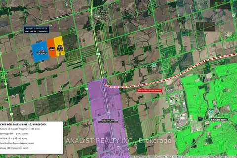
$250,000
3 bd2 ba10 pk1100-1500 ft²
4062 Line 10
Rural Bradford West Gwillimbury, Bradford West Gwillimbury
Detached · MLS® N13881298 · ANALYST REALTY INC.