1500 Birchmount Road Phase 3A
Wexford-Maryvale, Toronto, M1P 2G5
$1/mo
Listed 39 days ago · MLS® E13768310
About this home
Welcome to Birchmount Block! Construction is almost complete on a newly renovated, white-boxed flex industrial building with customizable units from 10,000 to 60,000 sf and clear heights from 14' to 24'. Large windows bring in lots of natural light. Excellent shipping with 7 truck level (3 interior) doors. Ample parking with additional land available for lease at the rear. Zoning permits a wide variety of uses including recreational. Current tenancies include Bond Academy private school and K1 Speed go-kart track. 10 minutes to Hwy 401 at Kennedy Rd and between express bus lines on Ellesmere Rd and Lawrence Ave. Occupancy as soon as Oct. 1, 2026. Zoning: General Industrial & Vehicle Service Zone, General Industrial Zone and Industrial Zone.
Details
- Type
- Industrial
- Lot
- 727 × 1210 ft
- Garage
- Outside/Surface
- Property tax
- $5 (2026)
- Neighbourhood
- Wexford-Maryvale
- Municipality
- Toronto E04
Heating, cooling and services
- Heating
- Gas Forced Air Open
- Water and sewer
- Sanitary+Storm
- Utilities
- Available
Building and exterior
- Building area
- 32,000 Sq Ft Divisible
Rental terms
- Minimum term
- 60 months
More
- Possession
- Flexible
- Cross street
- Birchmount Rd / Ellesmere Rd
- Business type
- Warehouse
Location
Location is approximate. See nearby homes on the map
The neighbourhood
Getting around Somewhat walkable
- 🚆 Kennedy GO3.3 km
Within a 10-minute walk: no grocery stores, 8 cafés and restaurants, 2 parks, 2 pharmacies. Nearest park: Manhattan Park (550 m).
Schools nearby
Elementary
- Manhattan Park Junior Public School10 min walk
- Ellesmere-Statton Public School
EQAO: Gr 6 reading 84%, math 62%13 min walk - Dorset Park Public School
EQAO: Gr 6 reading 88%, math 68%15 min walk - St. Lawrence Catholic School Catholic
EQAO: Gr 6 reading 85%, math 54%16 min walk
Secondary
- Winston Churchill Collegiate Institute
EQAO: Gr 9 math 22%, literacy test 65%1.3 km - Gooderham Learning Centre1.6 km
EQAO: share of students meeting the provincial standard (2024–25). Ontario average: Gr 6 reading 86%, math 51%; Gr 9 math 55%; literacy test 83%.
Closest schools, not school zones. Check which school serves this address with the school board before relying on it.
Who lives here postal area M1P
- Owners / renters
- 59% / 41%
- Median household income
- $76,000
- Average age
- 42
- Children under 15
- 15%
- Homes
- 25% detached, 51% high-rise
- Commute by transit
- 29%
- Population
- 45,170
Languages spoken most at home besides English: Tamil 5.6%, Yue (Cantonese) 4.3%, Mandarin 3.9%, Tagalog (Pilipino, Filipino) 3.5%.
Flood and conservation No mapped hazard
Not inside a mapped flood plain or regulated area.
Screening maps only. Ask the conservation authority for a property inquiry before relying on this.
Safety
Major crime per resident in Wexford/Maryvale (2025): 53% above the Toronto average, down 9% from the year before.
- Assault47% above average
- Break and enter34% above average
- Auto theft89% above average
- Robbery60% above average
- Theft from vehicles109% above average
- Shootings295% above average
Crime Severity Index for Toronto police: 60 vs 57 for Ontario (2025).
Police-reported figures for the whole neighbourhood, not this street. Rates use the area’s resident population.
Development nearby 2 active
-
1430 BIRCHMOUNT RD · 400 mPlan of Condominium · Under Review · applied 2025Draft Plan of Condominium. The proposed development contains two 3-storey warehouse units. Building A contains 29 Industrial units and 186 Work/Storage units.…Application details
-
1519 BIRCHMOUNT RD · 350 mOfficial Plan / Zoning By-law Amendment · Under Review · applied 2022OPA and rezoning application to permit an 8-storey rental apartment building containing 103 units.Application details
-
1430 BIRCHMOUNT RD · 400 mSite Plan · Closed · applied 2022Site Plan application to permit the development of 2 three-storey multi-unit industrial buildings each with two floors of individual warehouse units and one…Application details
Rezoning, site plan, subdivision and condominium applications filed with the city.
Distances are approximate. Places © OpenStreetMap contributors. Neighbourhood figures: Statistics Canada, 2021 Census. School results: EQAO via Ontario Data Catalogue (Open Government Licence – Ontario). Neighbourhood crime: Toronto Police Service Public Safety Data Portal (Open Government Licence – Toronto Police Service). Crime Severity Index: Statistics Canada. Planning applications: City of Toronto open data.
Living here
Commute
To Union Station (downtown Toronto): 14 km. Transit times · Driving times
Noise Nothing major nearby
No highway within 500 m, rail line within 300 m, or airport flight path nearby.
Distances from the map, not noise measurements. Visit at rush hour to judge for yourself.
Building permits
- Addition · 2026 · Revision IssuedREVISION 3 - north west corner corridor layout revisionREVISION 2 - renovation and addition to existing industrial warehouse within vacant…
- Sprinklers · 2026 · Permit IssuedProposal for sprinkler system alteration
- Interior Alterations · 2026 · Issuance PendingProposed interior alterations to convert existing industrial unit to a new go-karting facility (recreational use)
- Interior Alterations · 2024 · Permit IssuedInterior alterations to existing F2, converting to A2 type use for Bond Academy, including HVAC, Plumbing, Sprinklers, Structural,…
- Interior Alterations · 2020 · ClosedInterior Alterations - New interior overhead door in single tenant suite
4 permits on this block of the street in the last 2 years.
Permits filed with the City of Toronto. A permit doesn’t mean the work passed final inspection.
Trees
21 City street trees within 100 m, mostly honeys. That’s fewer than the Toronto average of 42.
Trees on City boulevards only, not private yards or parks.
Internet High-speed
50/10 Mbps or faster available here by cable, fibre or DSL (the federal high-speed target).
From the federal broadband map. Check exact speeds and providers for the address.
Zoning, heritage, building permits and street trees: City of Toronto open data (Open Government Licence – Toronto). Roads, rail, airports and planned stations © OpenStreetMap contributors. Internet: Innovation, Science and Economic Development Canada, National Broadband Data.
Listed by PSR.
Listing information provided by PropTx Innovations Inc. and TRREB; deemed reliable but not guaranteed accurate by PropTx.
Similar homes nearby
See more in Toronto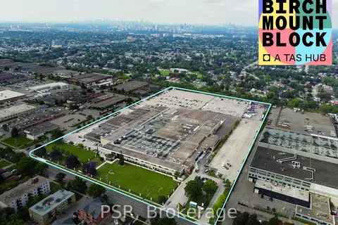
$1/mo
1500 Birchmount Road Phase 1
Wexford-Maryvale, Toronto
Industrial · MLS® E13768302 · PSR
$1/mo
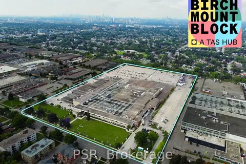
1500 Birchmount Road Phase 3
Wexford-Maryvale, Toronto
Industrial · MLS® E13768306 · PSR
$1/mo
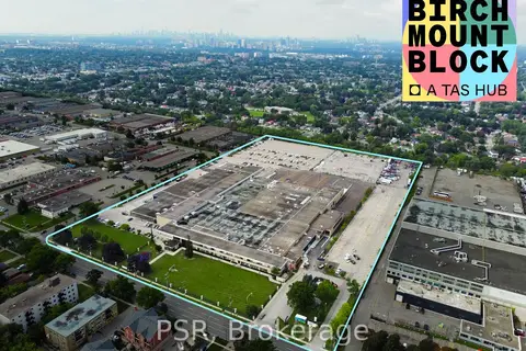
1500 Birchmount Road Phase 3C
Wexford-Maryvale, Toronto
Industrial · MLS® E13768316 · PSR
$1/mo
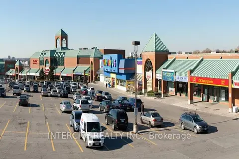
1448 - 1450 Lawrence Avenue E 304
Parkwoods-Donalda, Toronto
Office · MLS® C6766276 · INTERCITY REALTY INC.
$1/mo
Reduced $23
3080 Yonge Street 5055
Lawrence Park North, Toronto
Office · MLS® C6768656 · INTERCITY REALTY INC.
$1/mo
Reduced $17
3495 Lawrence Avenue E 202
Guildwood, Toronto
Office · MLS® E6763292 · INTERCITY REALTY INC.
$1/mo
Reduced $19
3495 Lawrence Avenue E 208
Guildwood, Toronto
Office · MLS® E6763300 · INTERCITY REALTY INC.
$1/mo
Reduced $17
3495 Lawrence Avenue E 210
Guildwood, Toronto
Office · MLS® E6763310 · INTERCITY REALTY INC.