130 Finkle Street
Woodstock - South, Woodstock, N4S 3E2
$7,000,000
- 0 bedrooms
- 0 bathrooms
Listed 61 days ago · MLS® X13695942
About this home
Rare Development Opportunity in the Heart of Woodstock! Final stage of Site Plan Approval, with an estimated post-approval value of $15M+. This is a chance to capture serious built-in upside. Rezoning underway (low to high density), clearing the path for an 8-storey, approximately 206-unit apartment building. Envisioned as a striking single-tower development with a mix of 1 & 2-bedroom suites, on-site parking and amenity space. Perfectly positioned minutes from Woodstock Station, Woodstock Hospital and Highway 401, with an easy commute to Kitchener, London and Brantford - right in the path of growth in one of Oxford County's fastest-expanding markets. Eligible for CMHC MLI Select Financing. Don't miss this rare shovel-ready-adjacent opportunity in a high-demand rental corridor! See attached Site Plan, Elevations & Survey (2025). AI-Generated Rendering, For Illustrative Purposes Only - Final Design/Layout/Materials/Site Conditions May Vary.
Details
- Type
- Vacant Land
- Lot
- 593.19 × 363.94 ft
- Kitchens
- 0
- Property tax
- $4,862 (2026)
- Neighbourhood
- Woodstock - South
- Municipality
- Woodstock
Building and exterior
- Faces
- North
Lot
- Size
- 593.19 × 363.94 ft
- Acreage
- 2-4.99
More
- Cross street
- Dundas St & Mill St
History of this address
3 earlier listings at this address, with sold and leased prices. Create a free account or sign in to see them.
Location
Location is approximate. See nearby homes on the map
Recent sales nearby
See what similar homes within 1 km sold for in the last year. Create a free account or sign in to see them.
The neighbourhood
Getting around Somewhat walkable
No subway, LRT or GO station within a short trip.
Within a 10-minute walk: 1 grocery store, 13 cafés and restaurants, 2 parks, 1 pharmacy. Nearest grocery: Foodland (950 m). Nearest park: Off Leash Dog Park (250 m).
Schools nearby
Elementary
- Central Public School
EQAO: Gr 6 reading 69%, math 25%11 min walk - Southside Public School
EQAO: Gr 6 reading 88%, math 54%12 min walk - St. Patrick's School Catholic
EQAO: Gr 6 reading 75%, math 44%15 min walk - Oliver Stephens Public School
EQAO: Gr 6 reading 93%, math 57%17 min walk
Secondary
- Woodstock Collegiate Institute
EQAO: Gr 9 math 54%, literacy test 88%10 min walk - College Avenue Secondary School
EQAO: Gr 9 math 28%, literacy test 66%15 min walk - St. Mary's High School Catholic
EQAO: Gr 9 math 48%, literacy test 82%1.6 km
EQAO: share of students meeting the provincial standard (2024–25). Ontario average: Gr 6 reading 86%, math 51%; Gr 9 math 55%; literacy test 83%.
Closest schools, not school zones. Check which school serves this address with the school board before relying on it.
Who lives here postal area N4S
- Owners / renters
- 66% / 34%
- Median household income
- $78,000
- Average age
- 43
- Children under 15
- 16%
- Homes
- 63% detached, 5% high-rise
- Commute by transit
- 1%
- Population
- 33,055
Languages spoken most at home besides English: Punjabi (Panjabi) 0.5%, Polish 0.3%, Spanish 0.3%, Portuguese 0.2%.
Safety
Crime Severity Index for Woodstock police: 62 vs 57 for Ontario (2025).
Police-reported figures for the whole police service area, not this street. Rates use the area’s resident population.
Distances are approximate. Places © OpenStreetMap contributors. Neighbourhood figures: Statistics Canada, 2021 Census. School results: EQAO via Ontario Data Catalogue (Open Government Licence – Ontario). Crime Severity Index: Statistics Canada.
Living here
Commute
Noise 1 source nearby
- 🚆 Rail line (Dundas Subdivision)100 m
Distances from the map, not noise measurements. Visit at rush hour to judge for yourself.
Internet High-speed
50/10 Mbps or faster available here by cable, fibre or DSL (the federal high-speed target).
From the federal broadband map. Check exact speeds and providers for the address.
Roads, rail, airports and planned stations © OpenStreetMap contributors. Internet: Innovation, Science and Economic Development Canada, National Broadband Data.
Listed by RE/MAX Icon Realty.
Listing information provided by PropTx Innovations Inc. and TRREB; deemed reliable but not guaranteed accurate by PropTx.
Similar homes nearby
See more in Woodstock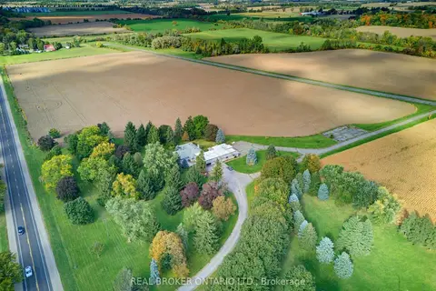
$6,900,000
3 bd3 ba13 pk3000-3500 ft²
595386 Highway 59 Highway
Woodstock - North, Woodstock
Farm · MLS® X13876724 · REAL BROKER ONTARIO LTD.