1144 Kingston Road
Town Centre, Pickering, L1V 2W9
$1,950,000
Listed 6 days ago · MLS® E14029702
About this home
Rare 20,742 sf (0.48 acre) development site on the north side of Kingston Road in Pickering's City Centre corridor, with 90.34 ft of frontage on a Regional arterial. Site-specific zoning is already in place: By-law 7432/15 zones the land MU-27, permitting medical office, office and retail store to a maximum 810 sq m gross floor area over two storeys. Municipal water, sanitary and storm services are in Kingston Road. The property is sold with the full development package assembled over four site plan submissions (City File S07/14): architectural drawings for a two-storey, 8,478 sf medical and commercial building with 31 surface parking stalls; civil and servicing design reviewed by the Region of Durham; landscape; photometric; a signed and stamped transportation assessment; a Phase I Environmental Site Assessment with Regional reliance; survey, topographic survey and draft reference plan. Site plan approval was not finalized and the 2016 minor variance has lapsed - the buyer completes the remaining approvals. Designated Mixed-Use Areas - Mixed Corridors in the Official Plan, permitting a floor space index up to 2.5, with the Kingston Road corridor identified for intensification. Access is right-in from Kingston Road with egress east to Walnut Lane over an easement the neighbouring owner is obliged to grant under its own registered site plan agreement. Easements for the Regional sanitary extension, reciprocal access and a future Kingston Road widening are set out on the draft reference plan. Minutes to Highway 401, Pickering GO Station and Pickering Town Centre. Buyer to satisfy itself as to permitted uses, servicing and development approvals.
Details
- Type
- Land
- Lot
- 90.34 × 257.22 ft
- Property tax
- $5,114 (2025)
- Neighbourhood
- Town Centre
- Municipality
- Pickering
Heating, cooling and services
- Water and sewer
- Sanitary Available
- Utilities
- Available
Building and exterior
- Building area
- 20,742 Square Feet
More
- Possession
- Vacant land. Immediate or flexible possession.
- Cross street
- Kingston Rd and Dixie Rd
- Business type
- Retail
History of this address
2 earlier listings at this address, with sold and leased prices. Create a free account or sign in to see them.
Location
Location is approximate. See nearby homes on the map
Recent sales nearby
See what similar homes within 1 km sold for in the last year. Create a free account or sign in to see them.
The neighbourhood
Getting around Very walkable
- 🚆 Pickering GO16 min walk
Within a 10-minute walk: 5 grocery stores, 27 cafés and restaurants, 3 parks, 4 pharmacies. Nearest grocery: Food Basics (350 m). Nearest park: David Farr Memorial Park South (550 m).
Schools nearby
Elementary
- Vaughan Willard Public School
EQAO: Gr 6 reading 77%, math 32%12 min walk - William Dunbar Public School
EQAO: Gr 6 reading 96%, math 74%16 min walk - Bayview Heights Public School
EQAO: Gr 6 reading 70%, math 15%1.5 km - Glengrove Public School
EQAO: Gr 6 reading 67%, math 15%1.5 km
Secondary
- Dunbarton High School
EQAO: Gr 9 math 71%, literacy test 86%2.1 km
EQAO: share of students meeting the provincial standard (2024–25). Ontario average: Gr 6 reading 86%, math 51%; Gr 9 math 55%; literacy test 83%.
Closest schools, not school zones. Check which school serves this address with the school board before relying on it.
Who lives here postal area L1V
- Owners / renters
- 86% / 14%
- Median household income
- $118,000
- Average age
- 42
- Children under 15
- 16%
- Homes
- 54% detached, 12% high-rise
- Commute by transit
- 8%
- Population
- 52,787
Languages spoken most at home besides English: Urdu 1.6%, Tamil 1.6%, Tagalog (Pilipino, Filipino) 0.9%, Mandarin 0.6%.
Flood and conservation No mapped hazard
Not inside a mapped flood plain or regulated area.
Screening maps only. Ask the conservation authority for a property inquiry before relying on this.
Safety
Crime Severity Index for Durham Region (Oshawa/Whitby/Ajax) police: 43 vs 57 for Ontario (2025).
Police-reported figures for the whole police service area, not this street. Rates use the area’s resident population.
Distances are approximate. Places © OpenStreetMap contributors. Neighbourhood figures: Statistics Canada, 2021 Census. School results: EQAO via Ontario Data Catalogue (Open Government Licence – Ontario). Crime Severity Index: Statistics Canada.
Living here
Commute
To Union Station (downtown Toronto): 31 km. Transit times · Driving times
Noise 1 source nearby
- 🛣️ Highway 401400 m
Distances from the map, not noise measurements. Visit at rush hour to judge for yourself.
Internet High-speed
50/10 Mbps or faster available here by cable, fibre or DSL (the federal high-speed target).
From the federal broadband map. Check exact speeds and providers for the address.
Roads, rail, airports and planned stations © OpenStreetMap contributors. Internet: Innovation, Science and Economic Development Canada, National Broadband Data.
Listed by YORK NATIONAL REALTY INC..
Listing information provided by PropTx Innovations Inc. and TRREB; deemed reliable but not guaranteed accurate by PropTx.
Similar homes nearby
See more in Pickering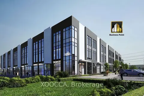
$1,699,999
1030 Salk Road B
Brock Industrial, Pickering
Industrial · MLS® E12987566 · XOOCCA