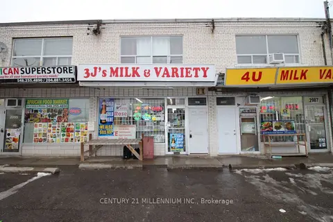
Condos Toronto 2991 Islington Ave
1 condo for rent in this building right now. In Humber Summit.
For sale 0
For rent 1
Storeys 2
About the building
Address 2991 Islington Ave, Toronto
Pets No
Property manager N/A
Units seen listed 1
From the listings in this building; details can vary by unit and change over time.
For rent in this building The neighbourhood
Getting around Walkable
🚇 Pearldale LRT 1.4 km 🚇 Rowntree Mills LRT 1.4 km 🚆 Etobicoke North GO 5.9 km
Within a 10-minute walk: no grocery stores, 8 cafés and restaurants, 5 parks, 2 pharmacies.
Nearest park: Plunkett park (450 m).
Schools nearby
Elementary St. Roch Catholic School Catholic EQAO: Gr 6 reading 91%, math 38% 11 min walk Venerable John Merlini Catholic School Catholic EQAO: Gr 6 reading 94%, math 88% 12 min walk Gracedale Public SchoolEQAO: Gr 3 reading 67%, math 45% 15 min walk North Kipling Junior Middle SchoolEQAO: Gr 6 reading 64%, math 35% 1.3 km Secondary Humber Summit Middle School 17 min walk North Albion Collegiate InstituteEQAO: Gr 9 math 29%, literacy test 70% 1.8 km EQAO: share of students meeting the provincial standard (2024–25). Ontario average: Gr 6 reading 86%, math 51%; Gr 9 math 55%; literacy test 83%.
Closest schools, not school zones. Check which school serves this address with the school board before relying on it.
Who lives here postal area M9L
Owners / renters 75% / 25%
Median household income $81,000
Average age 42
Children under 15 15%
Homes 14% detached, 16% high-rise
Commute by transit 19%
Population 11,737
Languages spoken most at home besides English: Italian 7.9%, Urdu 6.7%, Punjabi (Panjabi) 5.8%, Spanish 3.7%.
Flood and conservation No mapped hazard
Not inside a mapped flood plain or regulated area.
Screening maps only. Ask the conservation authority for a property inquiry before relying on this.
Safety
Major crime per resident in Humber Summit (2025): 88% above the Toronto average, down 6% from the year before.
Assault 34% above average Break and enter 110% above average Auto theft 199% above average Robbery 144% above average Theft from vehicles 34% above average Shootings 275% above average Crime Severity Index for Toronto police: 60 vs 57 for Ontario (2025).
Police-reported figures for the whole neighbourhood, not this street. Rates use the area’s resident population.
Development nearby 5 active
111 PLUNKETT RD · 300 m
Part Lot Control · Under Review · applied 2026
Part Lot Control Application for 12 lots.
Application details
139 MILLWICK DR · 250 m
Site Plan · Under Review · applied 2026
The proposed development involves a ground floor addition at the rear of the existing place of worship building, along with interior alterations.
Application details
135 PLUNKETT RD · 350 m
Site Plan · Under Review · applied 2025
Proposed six blocks of stacked, back to back townhouses. A total of 135 units are proposed. One level of underground parking is proposed.
Application details
111 PLUNKETT RD · 300 m
Official Plan / Zoning By-law Amendment · Council Approved · applied 2017
The proposal is for six blocks of stacked, back-to-back townhouses containing 151 units
Application details
135 PLUNKETT RD · 350 m
Plan of Subdivision · Under Review · applied 2017
Draft Plan of Subdivision to permit the development of 16 new residential lots (15 pairs of semi-detached dwellings and 1 detached dwelling). The new dwellings…
Application details
135 PLUNKETT RD · 350 m
Official Plan / Zoning By-law Amendment · Closed · applied 2023
The proposal is for six blocks of stacked, back-to-back townhouses containing 151 units
Application details
1 more within 500 m.
Rezoning, site plan, subdivision and condominium applications filed with the city.
Distances are approximate. Places © OpenStreetMap contributors. Neighbourhood figures: Statistics Canada, 2021 Census. School results: EQAO via Ontario Data Catalogue (Open Government Licence – Ontario). Neighbourhood crime: Toronto Police Service Public Safety Data Portal (Open Government Licence – Toronto Police Service). Crime Severity Index: Statistics Canada. Planning applications: City of Toronto open data.
Get an email when a unit here is listed
Be first to know about new listings in 2991 Islington Ave.
Thinking of selling a unit here? See what it’s worth or talk to Mehran .